England · United Kingdom
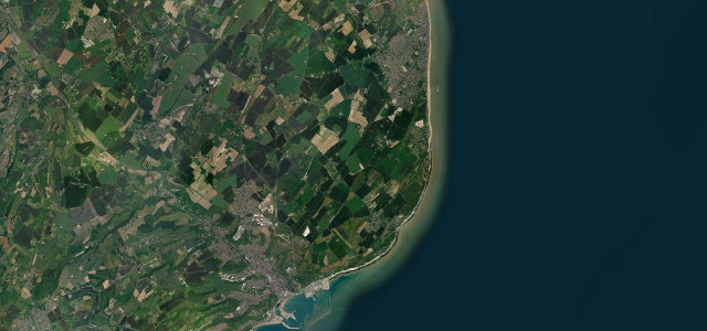
Dover to Deal
A258Dover to Deal
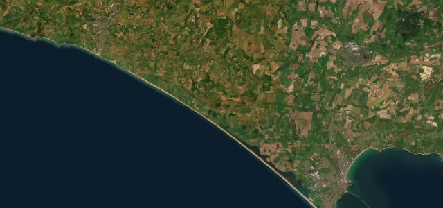
The white-cliffs coast road from Dover to Deal.
The A258 runs along the Kent coast from Dover up to Deal, above the famous white cliffs and St Margaret’s Bay, with the Channel, and France on a clear day, off to the east. A rolling, open road; mind the coastal crosswinds, cyclists grinding up the climbs, and the busy traffic near the ports and towns.
Where it runs8.5 mi · point to point
DoverStart · England
DealEnd · England
Navigate to the start: Apple Maps · Google Maps
Character
Corners18bends
Tightness3of 10
Max gradient6%≈ 1-in-17
Climb142 mtotal ascent
Summit124.3 mhighest point of the line · 408 ft
Corners
busiest around mile 8Elevation
under 4%4–8%over 8%3.3 – 124.3 mPoints of interest2 stops
- Dover Castle Spur TunnelsLandmark0.7 mi in
- Julius Caesar Landing plaqueLandmark7.6 mi in
Hazards
- Coastal crosswinds
- Cyclists on the climbs
- Port and town traffic
Sources
“The shaded S-bends, breath-taking elevations and fast sections alternating with slow scenic sections makes this road a must-drive”
Verified route: mapped from real road geometry and fact-checked by a human editor. How roads get checked
Driving the Dover to Deal: quick answers
How long does it take to drive the Dover to Deal?
Dover to Deal runs 8.5 miles (13.7 km) and takes about 16 min to drive without stops.
How difficult is the Dover to Deal to drive?
We rate it moderate: 18 corners, a maximum gradient of 6%, and a tightness of 3 out of 10.
When is the best time to drive the Dover to Deal?
Spring and Summer and Autumn are best.
Nearby roads
The closest great drives to Dover to Deal.
Dover to Deal
DirectionsGet the app