Auvergne-Rhône-Alpes · France
Col de la Faucille
D1005Gex to Les Rousses
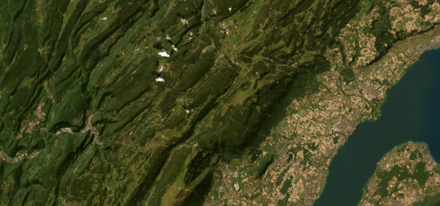
A Jura pass with a sudden, vast view over Lake Geneva to Mont Blanc.
The D1005 climbs the Col de la Faucille through the forests of the Jura above Gex, opening at the top to a sweeping view across Lake Geneva to the Alps and Mont Blanc beyond. Mind the cyclists, the fog in the trees, and ice in the colder months.
Where it runs18.8 mi · point to point
GexStart · Auvergne-Rhône-Alpes
Les RoussesEnd · Auvergne-Rhône-Alpes
Navigate to the start: Apple Maps · Google Maps
Character
Corners30bends
Tightness5of 10
Max gradient8%≈ 1-in-13
Hairpins5tight bends
Climb899 mtotal ascent
Summit1,332.6 mhighest point of the line · 4,372 ft
Corners
busiest around mile 2Elevation
under 4%4–8%over 8%603.5 – 1,332.6 mFrom the road
Points of interest3 stops
- Col de la FaucilleViewpoint7.2 mi in
- Le YétiLandmark18 mi in
- Buste de Louis PasteurLandmark19 mi in
Hazards
- Cyclists on the climbs
- Fog in the forest
- Ice in the colder months
Sources
“Shortly after, the road offers a breathtaking panorama of the Pays de Gex, Lake Geneva, and the Geneva conurbation.”
Verified route: mapped from real road geometry and fact-checked by a human editor. How roads get checked
Driving the Col de la Faucille: quick answers
How long does it take to drive the Col de la Faucille?
Col de la Faucille runs 18.8 miles (30 km) and takes about 38 min to drive without stops.
How difficult is the Col de la Faucille to drive?
We rate it moderate: 30 corners including 5 hairpins, a maximum gradient of 8%, and a tightness of 5 out of 10.
When is the best time to drive the Col de la Faucille?
Spring and Summer and Autumn are best.
Nearby roads
The closest great drives to Col de la Faucille.
Col de la Faucille
DirectionsGet the app