England · United Kingdom
Mam Tor and Rushup Edge
A6187Castleton to Wash
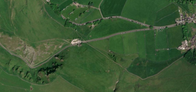
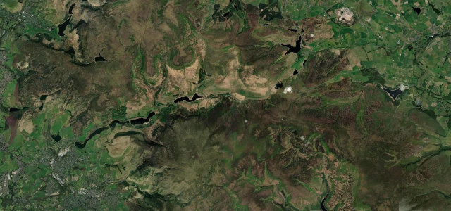
Out of Castleton and over Mam Nick beneath the slumping face of Mam Tor, then west along Rushup Edge with Kinder Scout and the Edale valley in view. Barely four miles, and the ridge crosswinds make sure you feel every one.
This road climbs from Castleton over Mam Nick beneath the slumping face of Mam Tor, then runs west along the Rushup Edge ridge. It offers open views toward Kinder Scout and the Edale valley before descending toward Chapel-en-le-Frith. Mind the exposed ridge crosswinds, walkers crossing near the Mam Nick car park and fog on the tops.
Where it runs4.1 mi · point to point
Navigate to the start: Apple Maps · Google Maps
Character
Corners
busiest around mile 2Elevation
under 4%4–8%over 8%190 – 435.2 mPoints of interest3 stops
- Speedwell CavernLandmark0.6 mi in
- Peveril Castle Visitor CentreLandmarkat the start
- Blue John CavernLandmark1.2 mi in
Hazards
- Exposed ridge crosswinds
- Walkers crossing at Mam Nick
- Frequent hill fog
Sources
“This is a dramatic drive with breathtaking scenery.”
Verified route: mapped from real road geometry and fact-checked by a human editor. How roads get checked
Driving the Mam Tor and Rushup Edge: quick answers
How long does it take to drive the Mam Tor and Rushup Edge?
How difficult is the Mam Tor and Rushup Edge to drive?
When is the best time to drive the Mam Tor and Rushup Edge?
Nearby roads
The closest great drives to Mam Tor and Rushup Edge.