England · United Kingdom
Wensleydale
A684Sedbergh to Hawes
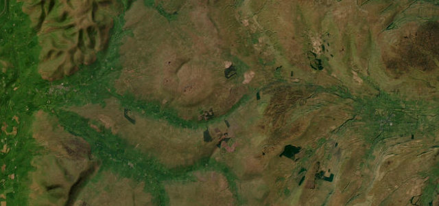
The A684 covers 15.9 miles from Sedbergh to Hawes, climbing Garsdale to the head of Wensleydale. Villages and livestock set the pace.
The A684 climbs Garsdale from Sedbergh to the head of Wensleydale at Hawes, a relaxed run between drystone walls and green fells. It is gentle by Dales standards but the villages, livestock and visitors all call for an easy pace.
If most great driving roads are espresso, this one is a proper pot of tea. Some mornings that’s exactly what we’re after.
Why we picked it
Scenery
ValleyMoorland
Best seasons
SpringSummerAutumn
In these collections
In these guides
Where it runs15.9 mi · point to point
SedberghStart · England
HawesEnd · England
Navigate to the start: Apple Maps · Google Maps
Character
Corners14bends
Tightness4of 10
Max gradient8%≈ 1-in-13
Climb325 mtotal ascent
Summit332.3 mhighest point of the line · 1,090 ft
Corners
busiest around mile 15Elevation
under 4%4–8%over 8%111.9 – 332.3 mPoints of interest3 stops
- Pike HillViewpoint16 mi in
- Tom Croft HillViewpoint2.7 mi in
- Sool RiggViewpoint2.6 mi in
Hazards
- Livestock and farm traffic
- Narrow village streets
- Cyclists
Sources
“potentially the fastest section of the day will present itself as the road threads along another ambrosial valley”
Verified route: mapped from real road geometry and fact-checked by a human editor. How roads get checked
Driving the Wensleydale: quick answers
How long does it take to drive the Wensleydale?
Wensleydale runs 15.9 miles (26 km) and takes about 30 min to drive without stops.
How difficult is the Wensleydale to drive?
We rate it moderate: 14 corners, a maximum gradient of 8%, and a tightness of 4 out of 10.
When is the best time to drive the Wensleydale?
Spring and Summer and Autumn are best.
Nearby roads
The closest great drives to Wensleydale.
Wensleydale
DirectionsGet the app