Scotland · United Kingdom
Appin Coast
A828South Ballachulish to North Connel
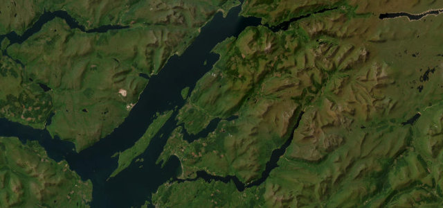
A scenic shore road past Castle Stalker between Ballachulish and Connel.
The A828 follows the Appin coast between Ballachulish and Connel, with views to Castle Stalker on its island and the hills of Morvern beyond. It is a flowing road; mind the bridges, the tourist traffic and the weather off the loch.
Where it runs25.7 mi · point to point
South BallachulishStart · Scotland
North ConnelEnd · Scotland
Navigate to the start: Apple Maps · Google Maps
Character
Corners22bends
Tightness4of 10
Max gradient7%≈ 1-in-14
Climb309 mtotal ascent
Summit58.7 mhighest point of the line · 193 ft
Corners
busiest around mile 17Elevation
under 4%4–8%over 8%2.8 – 58.7 mPoints of interest3 stops
- Loch Linnhe ViewpointViewpoint6.6 mi in
- Castle Stalker viewpointViewpoint12 mi in
- Duror and Kentallen War MemorialLandmark4.5 mi in
Hazards
- Narrow bridges
- Tourist traffic
- Coastal weather
Sources
“Between North Connel and the Ballachulish Roundabout lies the A828 along the shores of Loch Linnhe offering spectacular views both inland and across the Loch to the Morven Hills.”
Verified route: mapped from real road geometry and fact-checked by a human editor. How roads get checked
Driving the Appin Coast: quick answers
How long does it take to drive the Appin Coast?
Appin Coast runs 25.7 miles (41 km) and takes about 49 min to drive without stops.
How difficult is the Appin Coast to drive?
We rate it moderate: 22 corners, a maximum gradient of 7%, and a tightness of 4 out of 10.
When is the best time to drive the Appin Coast?
Spring and Summer and Autumn are best.
Nearby roads
The closest great drives to Appin Coast.
Appin Coast
DirectionsGet the app