Mehedinți / Caraș-Severin · Romania
Clisura Dunării
DN57Orșova to Moldova Nouă
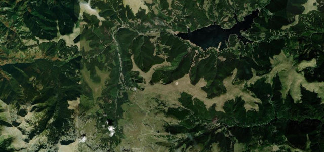
Romania’s most dramatic riverside drive: 95 km of DN57 hugging the Danube through the Iron Gates gorge, past towering limestone cliffs, the colossal Decebalus rock sculpture, and a succession of cave mouths and monasteries.
DN57 traces the left (Romanian) bank of the Danube as it carves through the Banat Mountains in the Iron Gates Natural Park. The road alternates between wide river panoramas and the intimate narrows of the Cazanele Mari and Cazanele Mici — the sections where the Danube pinches to its narrowest on its entire Romanian course. Landmarks appear in quick succession: the Mraconia Monastery, the Ponicova cave entrance, and the 55-metre Decebalus Rex cliff sculpture hewn from the rock above Dubova, while Golubac fortress on the Serbian shore provides a constant cross-river backdrop.
Scenery
Where it runs
Navigate to the start: Apple Maps · Google Maps
Character
Elevation
under 4%4–8%over 8%67 – 225 mHazards
- occasional road flooding near the river bank
- sharp bends with limited visibility
- tourist footfall creating sudden stops near the Decebalus sculpture
- narrow sections between Dubova and Coronini
Sources: Road geometry © OpenStreetMap contributors
Nearby roads
The closest great drives to Clisura Dunării.