Moravica District · Serbia
Ovčar-Kablar Gorge Road
23Čačak to Požega
Distance21.1 mi34 km
Drive time40 minon the road
DifficultyEasytightness 4 of 10
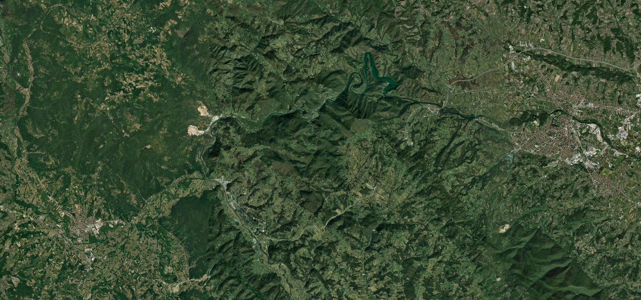
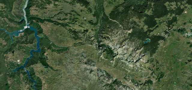
The West Morava cuts a spectacular 15 km gorge between Ovčar (985 m) and Kablar (889 m), carving three meanders so pronounced the river doubles back on itself, the road threading past a dozen monasteries, the 'Serbian Mount Athos'.
Leaving Čačak west, road 23 enters the gorge where the walls close in and the river begins its first meander, alternating riverbank shelf and short tunnels past monastery entrances cut into the hillside, completing three full river loops before relaxing toward Požega.
Scenery
GorgeValleyForest
Where it runs
ČačakStart · Moravica District
PožegaEnd · Moravica District
Navigate to the start: Apple Maps · Google Maps
Character
Corners22bends
Tightness4of 10
Max gradient8%≈ 1-in-13
Climb236 mtotal ascent
Summit374 mhighest point of the line · 1,227 ft
Elevation
under 4%4–8%over 8%240 – 374 mHazards
- narrow sections with oncoming traffic
- monastery traffic and pedestrians
Sources: Road geometry © OpenStreetMap contributors
Nearby roads
The closest great drives to Ovčar-Kablar Gorge Road.
Ovčar-Kablar Gorge Road
Directions