Waikato · New Zealand
Coromandel Coast Road
SH 25Thames to Coromandel
Winding pohutukawa-lined coast road north to Coromandel Town.
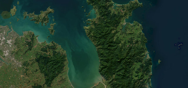
State Highway 25 follows the Thames Coast north from Thames to Coromandel Town, hugging the Firth of Thames and Hauraki Gulf for about 55 kilometres of near-continuous sea views. The narrow, winding road is lined with pohutukawa trees and passes a string of small bays on the western side of the Coromandel Peninsula. Mind the narrow winding sections, blind bays and slips after heavy rain.
Scenery
Best seasons
In these collections
Where it runs33.1 mi · point to point
Navigate to the start: Apple Maps · Google Maps
Character
Corners
busiest around mile 22Elevation
under 4%4–8%over 8%2.1 – 229.3 mFrom the road
Points of interest3 stops
- Birds LookoutViewpointat the start
- Goldmine ExperienceLandmark0.7 mi in
- Te Aputa PāLandmark7.0 mi in
Hazards
- Narrow winding sections close to the shore
- Slips and flooding after heavy rain
- Slow holiday traffic in summer
See the typical season and live conditions for the high passes ›
Sources
“The road is tight and narrow with occasional dips and potholes so you need your wits about you but some fun can be had well within the 100kph speed limit.”
Verified route: mapped from real road geometry and fact-checked by a human editor. How roads get checked
Driving the Coromandel Coast Road: quick answers
How long does it take to drive the Coromandel Coast Road?
How difficult is the Coromandel Coast Road to drive?
When is the best time to drive the Coromandel Coast Road?
Nearby roads
The closest great drives to Coromandel Coast Road.