Taranaki / Manawatu-Whanganui · New Zealand
Forgotten World Highway
SH 43Stratford to Taumarunui
A remote heritage run between Stratford and Taumarunui over three saddles, through a one-lane tunnel and the self-declared Republic of Whangamomona.
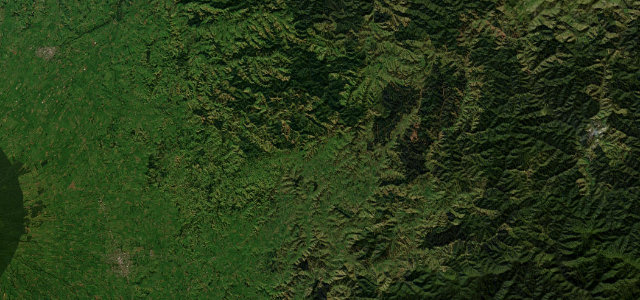
State Highway 43 threads 148 km of empty central North Island hill country, and the heart of it runs from Stratford up over the Strathmore and Whangamomona saddles to the tiny pub-republic of Whangamomona. The road climbs and dips through bush-clad ranges, squeezes through the single-lane Moki Tunnel (the Hobbit’s Hole) and winds along the Tangarakau Gorge. It is narrow, lightly trafficked and feels genuinely cut off from the modern world, which is the whole appeal. The last gravel section was finally sealed in 2025, but the carriageway stays tight and twisting throughout. Mind the narrow blind corners, the unlit one-lane Moki Tunnel, and the long stretches with no fuel or phone signal.
Scenery
Best seasons
In these collections
In these guides
Where it runs92.0 mi · point to point
Navigate to the start: Apple Maps · Google Maps
Character
Corners
busiest around mile 36Elevation
under 4%4–8%over 8%140 – 346.1 mFrom the road
Points of interest3 stops
- Strathmore SaddleViewpoint14 mi in
- Whangamōmona SaddleViewpoint35 mi in
- Pohokura SaddleLandmark28 mi in
Hazards
- Narrow blind corners
- Unlit single-lane Moki Tunnel
- No fuel or phone signal for long stretches
Sources
“The route winds its way across some seriously crinkly landscape, through gorges, tunnels, and dense forest.”
Verified route: mapped from real road geometry and fact-checked by a human editor. How roads get checked
Driving the Forgotten World Highway: quick answers
How long does it take to drive the Forgotten World Highway?
How difficult is the Forgotten World Highway to drive?
When is the best time to drive the Forgotten World Highway?
Nearby roads
The closest great drives to Forgotten World Highway.