Arizona · United States
Coronado Trail
US 191Alpine to Hannagan Meadow
Arizona’s wildest paved climb, reputedly 460 curves from the desert at Clifton up into spruce forest near Hannagan Meadow, on the old Route 666 alignment.
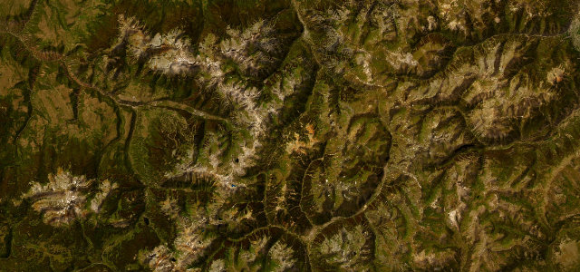
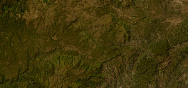
The Coronado Trail follows US 191 (formerly the notorious US 666, the 'Devil’s Highway') as it climbs from the copper-mine country around Clifton and Morenci up into the high White Mountains of eastern Arizona. The renowned stretch runs from the alpine village of Alpine south to Hannagan Meadow, where the road tops out around 9,370 feet, passing the Blue Vista overlook on the Mogollon Rim and a near-endless succession of tight, often blind switchbacks. It is widely cited as one of the least-travelled paved roads in the country and among the twistiest, with long stretches lacking guardrails and posted speeds dropping to walking pace on the worst bends. Most sources reckon on three to four hours to cover the full byway. Mind the unfenced drop-offs, the slow logging and ranch traffic, and ice or fog that linger at altitude well into spring.
Where it runs22.4 mi · point to point
Navigate to the start: Apple Maps · Google Maps
Character
Corners
busiest around mile 2Elevation
under 4%4–8%over 8%2,349.2 – 2,768.3 mPoints of interest1 stop
- Hannagan Meadow LodgeHistoric 1926 log lodge and restaurant at 9100ft, the classic meal and rest stop at the high point of the byway22 mi in
Hazards
- Unfenced drop-offs on blind switchbacks
- Slow logging and ranch traffic
- Ice and fog at altitude
Sources
“It has it all: snowy mountains, grassy valleys, animals aplenty, driving excitement, and ridiculous views.”
Verified route: mapped from real road geometry and fact-checked by a human editor. How roads get checked
Driving the Coronado Trail: quick answers
How long does it take to drive the Coronado Trail?
How difficult is the Coronado Trail to drive?
When is the best time to drive the Coronado Trail?
Nearby roads
The closest great drives to Coronado Trail.