Wales · United Kingdom
Elan Valley
Llansantffraed-Cwmdeuddwr to Craig Goch
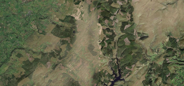
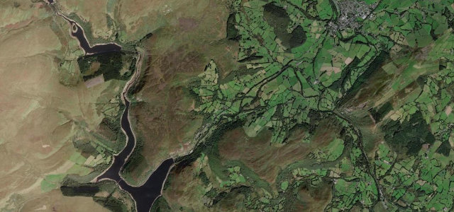
Narrow tarmac past the Victorian dams built to supply Birmingham, from Caban Coch up to Craig Goch, before the climb onto the Cambrian watershed.
This narrow unclassified road leaves the B4518 west of Rhayader and threads past the chain of Elan Valley dams and reservoirs built to supply Birmingham. It runs beside Caban Coch, Garreg Ddu, Pen y Garreg and Craig Goch before climbing onto the Cambrian watershed. Mind the unmarked single-lane sections, dam-visitor traffic and slippery stone surfaces after rain.
Scenery
Best seasons
In these collections
In these Grand Tours
Where it runs7.6 mi · point to point
Navigate to the start: Apple Maps · Google Maps
Character
Corners
busiest around mile 7Elevation
under 4%4–8%over 8%193.4 – 305.1 mPoints of interest1 stop
- Rhayader CastleLandmarkat the start
Hazards
- Narrow unmarked lanes
- Heavy visitor traffic at dams
- Sheep on open sections
- Slippery stone surfaces after rain
Sources
“The stretch of road away from Craig Goch ranks in the list of most challenging roads you'll find anywhere in Britain.”
Verified route: mapped from real road geometry and fact-checked by a human editor. How roads get checked
Driving the Elan Valley: quick answers
How long does it take to drive the Elan Valley?
How difficult is the Elan Valley to drive?
When is the best time to drive the Elan Valley?
Nearby roads
The closest great drives to Elan Valley.