Provence-Alpes-Côte d'Azur · France
Gorges du Cians
D28Beuil to Rigaud
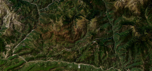
Red-rock balcony gorge in the Alpes-Maritimes, cut by the Cians torrent.
The D28 threads the Gorges du Cians, a deep canyon of iron-red rock carved by the River Cians between Beuil and Touet-sur-Var. The river drops roughly 1,600 m over its length, and the road clings to the cliffs through a series of short rock tunnels and narrow clues. The lane is single-track in the narrowest sections with sheer drops, rockfall and no barriers in places.
Scenery
GorgeMountain
Best seasons
SpringSummerAutumn
In these collections
Where it runs13.0 mi · point to point
BeuilStart · Provence-Alpes-Côte d'Azur
RigaudEnd · Provence-Alpes-Côte d'Azur
Navigate to the start: Apple Maps · Google Maps
Character
Corners90bends
Tightness8of 10
Max gradient9%≈ 1-in-11
Hairpins5tight bends
Descent1,539 mapproximate · DEM-limited
Summit1,422.5 mapproximate · DEM-limited
Corners
busiest around mile 1Elevation
approximateunder 4%4–8%over 8%345 – 1,422.5 mFrom the road
Points of interest3 stops
- Gorges du CiansLandmark4.8 mi in
- Grande ClueLandmark4.1 mi in
- Petite ClueLandmark5.1 mi in
Hazards
- Single-lane sections cut into cliffs with no barrier
- Unlit and low rock tunnels
- Rockfall and rock debris
Sources
“The deep gorge carved through the mountains by the River Cians is made all the more spectacular by the deep red of the exposed rock”
Verified route: mapped from real road geometry and fact-checked by a human editor. How roads get checked
Driving the Gorges du Cians: quick answers
How long does it take to drive the Gorges du Cians?
Gorges du Cians runs 13.0 miles (21 km) and takes about 30 min to drive without stops.
How difficult is the Gorges du Cians to drive?
We rate it demanding: 90 corners including 5 hairpins, a maximum gradient of 9%, and a tightness of 8 out of 10.
When is the best time to drive the Gorges du Cians?
Spring and Summer and Autumn are best.
Nearby roads
The closest great drives to Gorges du Cians.
Gorges du Cians
DirectionsGet the app