Uri · Switzerland
Oberalp Pass
19Andermatt to Tujetsch
A lake-topped pass at the source of the Rhine.
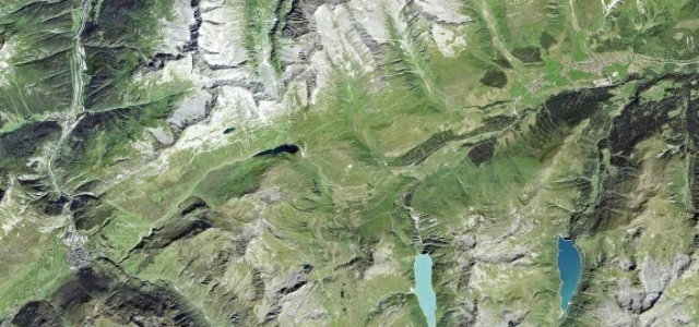
The Oberalp Pass at 2,044 m links Andermatt and the Surselva past a small lake near the source of the Rhine, the road shadowing the Glacier Express railway. Sweeping hairpins and big open views; mind the trains at the crossings, the cyclists, and snow that closes it much of the year.
Scenery
MountainLakes
Best seasons
SummerAutumn
In these collections
In these Grand Tours
Where it runs14.5 mi · point to point
AndermattStart · Uri
TujetschEnd · Uri
Navigate to the start: Apple Maps · Google Maps
Character
Corners34bends
Tightness6of 10
Max gradient9%≈ 1-in-11
Hairpins12tight bends
Climb688 mtotal ascent
Summit2,076.2 mhighest point of the line · 6,812 ft
Corners
busiest around mile 1Elevation
under 4%4–8%over 8%1,339 – 2,076.2 mFrom the road
Points of interest3 stops
- OberalppassViewpoint6.7 mi in
- StockViewpoint3.6 mi in
- ehem. SpecksteinbruchLandmark7.5 mi in
Hazards
- Railway crossings
- Cyclists on the hairpins
- Closed much of the year
See the typical season and live conditions for the high passes ›
Sources
“The road is very steep, hitting a 10% maximum gradient.”
Verified route: mapped from real road geometry and fact-checked by a human editor. How roads get checked
Driving the Oberalp Pass: quick answers
How long does it take to drive the Oberalp Pass?
Oberalp Pass runs 14.5 miles (23 km) and takes about 30 min to drive without stops.
How difficult is the Oberalp Pass to drive?
We rate it demanding: 34 corners including 12 hairpins, a maximum gradient of 9%, and a tightness of 6 out of 10.
When is the best time to drive the Oberalp Pass?
Summer and Autumn are best.
Nearby roads
The closest great drives to Oberalp Pass.
Oberalp Pass
DirectionsGet the app