Zadar County · Croatia
Pag Island Karst Road
D106Pag to Novalja
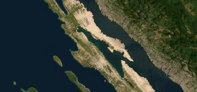
Lunar karst spine road from Pag town to Novalja.
The D106 runs the length of Pag island, from Pag town north through the bare, wind-scoured karst toward the olive groves of the Lun peninsula. The treeless stone landscape gives long open sea views on one side and rock on the other. Mind the strong bora crosswinds, free-roaming sheep and the narrow exposed sections.
Scenery
CoastMoorlandValley
Best seasons
SpringSummerAutumn
In these collections
In these guides
Where it runs19.2 mi · point to point
PagStart · Zadar County
NovaljaEnd · Zadar County
Navigate to the start: Apple Maps · Google Maps
Character
Corners55bends
Tightness4of 10
Max gradient7%≈ 1-in-14
Hairpins1tight bends
Climb486 mtotal ascent
Summit168.2 mhighest point of the line · 552 ft
Corners
busiest around mile 18Elevation
under 4%4–8%over 8%-0 – 168.2 mFrom the road
Points of interest3 stops
- Sirana Gligora (Pag cheese dairy)Landmark10 mi in
- KonjarViewpoint12 mi in
- MarmanViewpoint17 mi in
Hazards
- Strong bora crosswinds
- Free-roaming sheep
- Exposed narrow sections
Sources
“a very scenic drive located in the heart of Pag, a Croatian island in the northern Adriatic Sea... offers stunning views of the barren rock island”
Verified route: mapped from real road geometry and fact-checked by a human editor. How roads get checked
Driving the Pag Island Karst Road: quick answers
How long does it take to drive the Pag Island Karst Road?
Pag Island Karst Road runs 19.2 miles (31 km) and takes about 37 min to drive without stops.
How difficult is the Pag Island Karst Road to drive?
We rate it easy: 55 corners including 1 hairpins, a maximum gradient of 7%, and a tightness of 4 out of 10.
When is the best time to drive the Pag Island Karst Road?
Spring and Summer and Autumn are best.
Nearby roads
The closest great drives to Pag Island Karst Road.
Pag Island Karst Road
DirectionsGet the app