Scotland · United Kingdom
Quiraing and the Trotternish Loop
Uig to Staffin
Single-track switchback over Skye’s landslip ridge to Staffin.
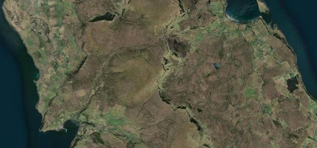
This single-track road crosses the Trotternish ridge between Uig and Staffin, climbing past the Quiraing landslip with views over moorland and surrounding isles. It runs as part of the wider A855 Trotternish loop on northern Skye. Mind the steep gradients, frequent potholes and heavy tourist traffic at the summit car park.
Where it runs9.9 mi · point to point
UigStart · Scotland
StaffinEnd · Scotland
Navigate to the start: Apple Maps · Google Maps
Character
Corners40bends
Tightness7of 10
Max gradient15%≈ 1-in-7
Hairpins1tight bends
Climb256 mtotal ascent
Summit263 mhighest point of the line · 863 ft
Corners
busiest around mile 6Elevation
under 4%4–8%over 8%10.1 – 263 mPoints of interest3 stops
- Quiraing VistaViewpoint6.1 mi in
- Rha WaterfallLandmark0.6 mi in
- Staffin Dinosaur FootprintsLandmark9.9 mi in
Hazards
- Steep single-track climb
- Frequent potholes
- Heavy tourist traffic
Sources
“It is a winding single paved track, with hairpin turns and very narrow.”
Verified route: mapped from real road geometry and fact-checked by a human editor. How roads get checked
Driving the Quiraing and the Trotternish Loop: quick answers
How long does it take to drive the Quiraing and the Trotternish Loop?
Quiraing and the Trotternish Loop runs 9.9 miles (15.9 km) and takes about 22 min to drive without stops.
How difficult is the Quiraing and the Trotternish Loop to drive?
We rate it moderate: 40 corners including 1 hairpins, a maximum gradient of 15%, and a tightness of 7 out of 10.
When is the best time to drive the Quiraing and the Trotternish Loop?
Spring and Summer and Autumn are best.
Nearby roads
The closest great drives to Quiraing and the Trotternish Loop.
Quiraing and the Trotternish Loop
DirectionsGet the app