Andalusia · Spain
Ronda Mountain Road
A-397Marbella to Ronda
A sweeping climb from the coast to clifftop Ronda.
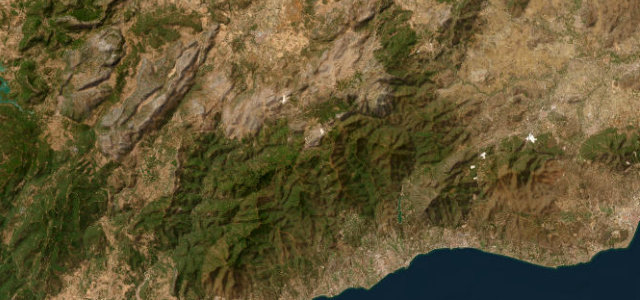
The A-397 climbs from San Pedro de Alcántara on the Costa del Sol up over the Serranía de Ronda to the dramatic clifftop town of Ronda, a long, well-surfaced sweep of bends through the sierra. A driver’s favourite; watch for cyclists, slow lorries on the climbs, and goats on the open mountain.
Where it runs30.3 mi · point to point
MarbellaStart · Andalusia
RondaEnd · Andalusia
Navigate to the start: Apple Maps · Google Maps
Character
Corners44bends
Tightness6of 10
Max gradient8%≈ 1-in-13
Hairpins1tight bends
Climb1,308 mtotal ascent
Summit1,122.8 mhighest point of the line · 3,684 ft
Corners
busiest around mile 29Elevation
under 4%4–8%over 8%46.5 – 1,122.8 mFrom the road
Points of interest3 stops
- Puerto del MadroñoViewpoint14 mi in
- Puerto de la AlizadaViewpoint6.1 mi in
- Monumento a RilkeLandmark19 mi in
Hazards
- Slow lorries on the climbs
- Cyclists on the bends
- Goats on the mountain
Sources
“nearly 50km of cornering heaven. It features an incredible mix of bends but what makes it so popular is the way it flows so well together”
Verified route: mapped from real road geometry and fact-checked by a human editor. How roads get checked
Driving the Ronda Mountain Road: quick answers
How long does it take to drive the Ronda Mountain Road?
Ronda Mountain Road runs 30.3 miles (49 km) and takes about 1 h 4 min to drive without stops.
How difficult is the Ronda Mountain Road to drive?
We rate it demanding: 44 corners including 1 hairpins, a maximum gradient of 8%, and a tightness of 6 out of 10.
When is the best time to drive the Ronda Mountain Road?
Spring and Summer and Autumn are best.
Nearby roads
The closest great drives to Ronda Mountain Road.
Ronda Mountain Road
DirectionsGet the app