Andalusia · Spain
Sierra Nevada
A-395Granada to Monachil
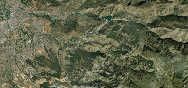
Climbing toward the Pico Veleta, Europe’s highest paved road, high above Granada.
The A-395 climbs from Granada into the Sierra Nevada toward the Pico Veleta, whose summit road is the highest paved road in Europe. The public A-395 tops out above 2,500 m at the ski station, where it closes to traffic. A long, thin-air ascent with huge views; carry warm clothes, watch for altitude and snow, and check it’s open.
Where it runs23.9 mi · point to point
GranadaStart · Andalusia
MonachilEnd · Andalusia
Navigate to the start: Apple Maps · Google Maps
Character
Corners40bends
Tightness5of 10
Max gradient9%≈ 1-in-11
Hairpins2tight bends
Climb1,985 mtotal ascent
Summit2,520.3 mhighest point of the line · 8,269 ft
Corners
busiest around mile 24Elevation
under 4%4–8%over 8%672.2 – 2,520.3 mFrom the road
Points of interest3 stops
- Mirador de las PerillasViewpoint8.7 mi in
- Mirador de los EnamoradosViewpoint8.8 mi in
- Collado de las SabinasViewpoint21 mi in
Hazards
- Thin air and altitude
- Snow and closures up top
- Cyclists on the climb
See the typical season and live conditions for the high passes ›
Sources
“The first few kilometers are tough with sections at 14%, 15%, and 17%, but the scenery is fantastic, and there is almost no traffic on the road.”
Verified route: mapped from real road geometry and fact-checked by a human editor. How roads get checked
Driving the Sierra Nevada: quick answers
How long does it take to drive the Sierra Nevada?
Sierra Nevada runs 23.9 miles (38 km) and takes about 48 min to drive without stops.
How difficult is the Sierra Nevada to drive?
We rate it demanding: 40 corners including 2 hairpins, a maximum gradient of 9%, and a tightness of 5 out of 10.
When is the best time to drive the Sierra Nevada?
Summer and Autumn are best.
Nearby roads
The closest great drives to Sierra Nevada.
Sierra Nevada
DirectionsGet the app