Almería · Spain
Alto de Velefique
AL-3102Velefique to Bacares
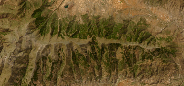
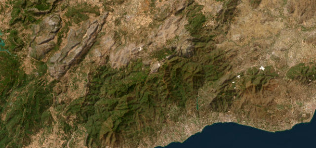
Roughly two dozen hairpins climb from the semi-desert at Velefique to a bare 1791 m crest of the Sierra de los Filabres, a Vuelta summit finish with hardly any traffic.
The AL-3102 climbs the northern flank of the Sierra de los Filabres between the village of Velefique and Bacares, and it is widely called the Spanish Stelvio for good reason. From Velefique the road stacks roughly two dozen tight hairpins up an almost lunar, near-treeless slope, with the cyclist Miguel Indurain’s name painted on a rock face near the top. The surface is reportedly excellent and traffic is light, which is part of the appeal, and the Vuelta a Espana has used it repeatedly as an especial-category summit finish. The contrast of starting in semi-desert and finishing on an exposed 1791 m ridge is the signature. Mind the ramps that touch around 11 percent, the lack of barriers above the drops, and occasional winter closures up top.
Where it runs15.4 mi · point to point
Navigate to the start: Apple Maps · Google Maps
Character
Corners
busiest around mile 5Elevation
under 4%4–8%over 8%943.4 – 1,827.3 mFrom the road
Points of interest3 stops
- Alto de VelefiqueViewpoint7.1 mi in
- Mirador de El PedregalViewpoint6.7 mi in
- Collado de SolaViewpoint8.3 mi in
Hazards
- Steep ramps near 17 percent
- Unguarded drops on the hairpins
- Occasional winter closures at the summit
See the typical season and live conditions for the high passes ›
Sources
“a sensational mountain road with a bewildering array of corners, climbing through the parched landscape”
Verified route: mapped from real road geometry and fact-checked by a human editor. How roads get checked
Driving the Alto de Velefique: quick answers
How long does it take to drive the Alto de Velefique?
How difficult is the Alto de Velefique to drive?
When is the best time to drive the Alto de Velefique?
Nearby roads
The closest great drives to Alto de Velefique.