Serra Geral, Santa Catarina · Brazil
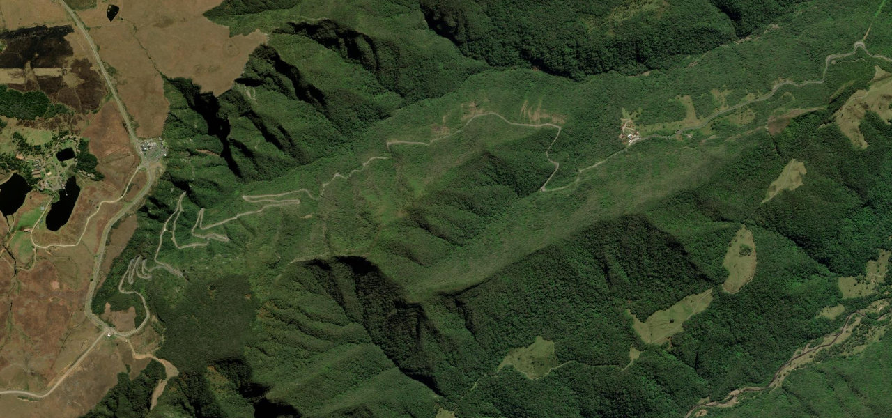
Serra do Rio do Rastro
SC-390Lauro Müller to Bom Jardim da Serra
Brazil’s most celebrated driving road: a 14 km wall of stacked hairpin bends scaling the Serra Geral escarpment through Atlantic Forest, rising 944 m from the coastal plain to the high plateau, the country’s answer to the Stelvio.
From the lowlands near Lauro Müller the road attacks the escarpment immediately, stacking hairpin upon hairpin through dense Atlantic rainforest as it climbs to the top at 1,465 m above Bom Jardim da Serra. The mirante at the summit gives a bird’s-eye view of the entire switchback wall below. Best driven bottom to top in the morning before mist closes in.
Scenery
Where it runs
Navigate to the start: Apple Maps · Google Maps
Character
Elevation
under 4%4–8%over 8%665 – 1,409 mHazards
- hundreds of hairpin bends
- steep gradients up to 11.5%
- frequent mist and low cloud
- slow trucks
- motorcyclists
Sources: Road geometry © OpenStreetMap contributors
Nearby roads
The closest great drives to Serra do Rio do Rastro.