High Atlas · Morocco
Tizi n'Tichka
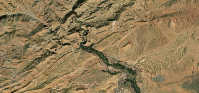
N9Zerkten to Agouim
Distance34.0 mi55 km
Drive time1 h 11 minon the road
DifficultyDemandingtightness 6 of 10
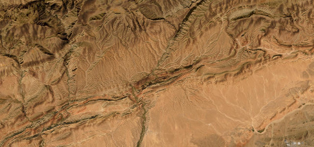
The highest major mountain pass in North Africa, the N9 climbs to 2,205 m through the High Atlas on a relentless procession of switchbacks before revealing a vast desert panorama on the descent.
The road tightens at Zerkten into a corridor of red-ochre cliffs and terraced Berber villages, grinding through hundreds of turns to crest the pass at 2,205 m. The descent south unravels into desert-like terrain — green to ochre to rust — past the ancient kasbah of Telouet, confirming the road’s role as a historic trade gateway before the drop toward the Ouarzazate plain.
Where it runs
ZerktenStart · High Atlas
AgouimEnd · High Atlas
Navigate to the start: Apple Maps · Google Maps
Character
Corners128bends
Tightness6of 10
Max gradient12%≈ 1-in-8
Hairpins5tight bends
Climb950 mtotal ascent
Summit2,231 mhighest point of the line · 7,320 ft
Elevation
under 4%4–8%over 8%1,260 – 2,231 mHazards
- hundreds of switchbacks
- no crash barriers on exposed sections
- heavy truck traffic
- snow and ice November to March
- no road lighting
- speed traps
Sources: Road geometry © OpenStreetMap contributors
Nearby roads
The closest great drives to Tizi n'Tichka.
Tizi n'Tichka
Directions