California · United States
Angeles Crest Highway
CA 2SR 2La Cañada Flintridge to Wrightwood
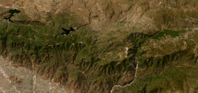
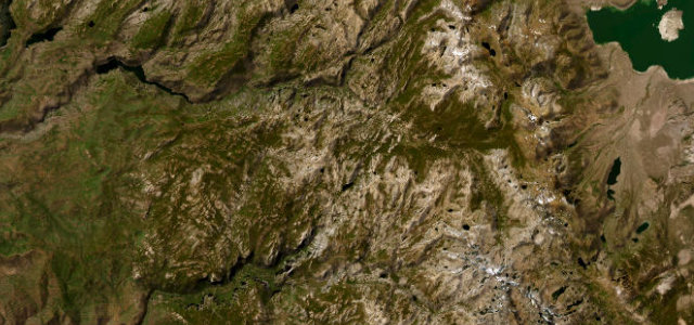
CA 2 climbs out of La Cañada Flintridge and spends 57 miles riding the ridgelines of the Angeles National Forest to Wrightwood, high above the LA basin. Near-empty, uninterrupted curves have made it the favourite of the city’s drivers and riders.
CA 2 climbs out of La Cañada Flintridge into the San Gabriel Mountains, winding for miles along the ridgelines of the Angeles National Forest toward Wrightwood, a driver’s and rider’s favourite high above the LA basin. Mind the cyclists and motorbikes, the rockfall, and sections that close for snow in winter.
Los Angeles’s mountain escape, the CA-2 climbing high into the San Gabriels. Miles of near-empty, uninterrupted curves make it the city’s favourite driver’s road.
Why we picked it
Scenery
Best seasons
In these collections
In these guides
Where it runs56.7 mi · point to point
Navigate to the start: Apple Maps · Google Maps
Character
Corners
busiest around mile 10Elevation
under 4%4–8%over 8%583.2 – 2,413 mFrom the road
Points of interest3 stops
- Clear Creek VistaViewpoint6.4 mi in
- Jarvi Memorial Observation SiteViewpoint37 mi in
- Inspiration Point VistaViewpoint51 mi in
Hazards
- Cyclists and motorbikes on blind bends
- Rockfall on the carriageway
- Winter snow closures
See the typical season and live conditions for the high passes ›
Sources
“came away convinced that it's one of the best driving roads in the country”
Verified route: mapped from real road geometry and fact-checked by a human editor. How roads get checked
Driving the Angeles Crest Highway: quick answers
How long does it take to drive the Angeles Crest Highway?
How difficult is the Angeles Crest Highway to drive?
When is the best time to drive the Angeles Crest Highway?
Nearby roads
The closest great drives to Angeles Crest Highway.