California · United States
Pacific Coast Highway, Big Sur
CA 1SR 1Carmel to Big Sur
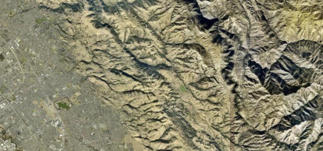
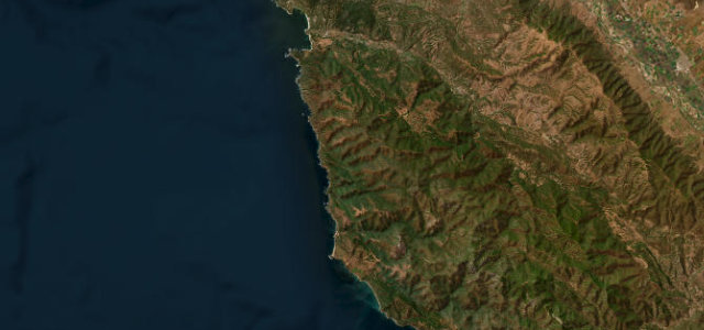
Highway 1 runs 23.4 miles south along the California coast from Carmel to Big Sur, crossing the Bixby Bridge on the way.
Highway 1 through Big Sur is one of the world’s great coast drives, a ribbon of tarmac clinging to the cliffs from Carmel south past the Bixby Bridge toward San Simeon, the Pacific crashing far below. Slow, spectacular and busy; mind the tourists stopping for photos, the sea fog, and the rockfall closures.
It rides the cliff edge, redwood canyons on one side and open Pacific far below, every bend turning to blue water. Smooth tarmac, headland after headland.
Why we picked it
Scenery
Best seasons
Featured in
In these collections
In these guides
Where it runs23.4 mi · point to point
Navigate to the start: Apple Maps · Google Maps
Character
Corners
busiest around mile 14Elevation
under 4%4–8%over 8%4.8 – 173.8 mFrom the road
Points of interest3 stops
- China LookoutViewpoint5.2 mi in
- Kasler PointViewpoint9.5 mi in
- Sea Otter Refuge View PointViewpoint14 mi in
Hazards
- Cliff edges with stopping traffic
- Sudden coastal fog
- Rockfall closures
See the typical season and live conditions for the high passes ›
Sources
“one of the most scenic driving routes in the United States”
Verified route: mapped from real road geometry and fact-checked by a human editor. How roads get checked
Driving the Pacific Coast Highway, Big Sur: quick answers
How long does it take to drive the Pacific Coast Highway, Big Sur?
How difficult is the Pacific Coast Highway, Big Sur to drive?
When is the best time to drive the Pacific Coast Highway, Big Sur?
Nearby roads
The closest great drives to Pacific Coast Highway, Big Sur.