Western Cape · South Africa
Bain's Kloof Pass
R301Wellington to Wolseley
Tarred 1850s convict-built pass above the Witte River.
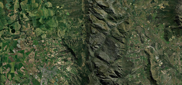
The R301 crosses the mountains between Wellington and the Breede River valley, peaking at 594 m. Engineered by Andrew Geddes Bain and opened in 1854 using convict labour, it is now a national monument and follows a precipitous cleft past pools and waterfalls. Mind the narrow tarmac, sharp corners and rockfall.
Scenery
MountainGorgeValley
Best seasons
SpringSummerAutumn
In these collections
In these guides
Where it runs17.6 mi · point to point
WellingtonStart · Western Cape
WolseleyEnd · Western Cape
Navigate to the start: Apple Maps · Google Maps
Character
Corners140bends
Tightness8of 10
Max gradient20%≈ 1-in-5
Climb475 mtotal ascent
Summit598.1 mhighest point of the line · 1,962 ft
Steeper than 9 in 10 roads here in the catalogue.
Corners
busiest around mile 5Elevation
under 4%4–8%over 8%134.7 – 598.1 mPoints of interest3 stops
- Sunset ViewpointViewpoint8.2 mi in
- Bain’s Kloof PassViewpoint9.0 mi in
- Tweede TolLandmark13 mi in
Hazards
- Narrow tarred carriageway
- Steep drop-offs
- Rockfall after rain
Sources
“Drive slowly and enjoy the incredible scenery - this is one of the Western Cape's top passes.”
Verified route: mapped from real road geometry and fact-checked by a human editor. How roads get checked
Driving the Bain's Kloof Pass: quick answers
How long does it take to drive the Bain's Kloof Pass?
Bain’s Kloof Pass runs 17.6 miles (28 km) and takes about 41 min to drive without stops.
How difficult is the Bain's Kloof Pass to drive?
We rate it demanding: 140 corners, a maximum gradient of 20%, and a tightness of 8 out of 10.
When is the best time to drive the Bain's Kloof Pass?
Spring and Summer and Autumn are best.
Nearby roads
The closest great drives to Bain's Kloof Pass.
Bain's Kloof Pass
DirectionsGet the app