Nova Scotia · Canada
Cabot Trail
Cape Breton Highlands National Park to Ingonish
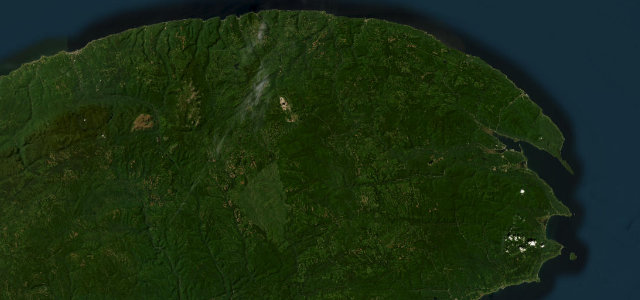
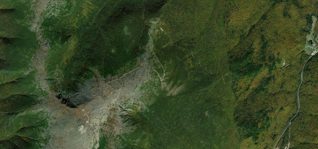
Completed in 1932 and named for John Cabot, it climbs from Cheticamp over French Mountain at 455 m, switchbacks down MacKenzie Mountain and drops over Cape Smokey to Ingonish. The moose have the plateau at dawn and dusk.
The Cabot Trail’s most celebrated stretch threads the Cape Breton Highlands National Park, climbing from the Acadian village of Cheticamp over French Mountain, the route’s high point at 455 m, then switchbacking down MacKenzie Mountain before crossing Cape North and descending Cape Smokey to Ingonish. Completed in 1932 and named for explorer John Cabot, this paved primary road pairs sweeping clifftop ocean views with forested highland plateau. The Skyline Trail headland walk leaves the road at French Mountain, and the Keltic Lodge marks the eastern end near Ingonish. Mind the steep grades, tight switchbacks, sudden coastal fog and gusty winds, and moose on the plateau at dawn and dusk.
It clings to the cliffs of Cape Breton, climbing and plunging through the Highlands with the sea glittering far below.
Why we picked it
Scenery
Best seasons
In these collections
Where it runs61.2 mi · point to point
Navigate to the start: Apple Maps · Google Maps
Character
Corners
busiest around mile 18Elevation
under 4%4–8%over 8%1.8 – 460.1 mFrom the road
Points of interest2 stops
- Lakies HeadViewpoint57 mi in
- Lone ShielingLandmark26 mi in
Hazards
- Steep grades
- Tight switchbacks
- Coastal fog
- Gusty winds
- Moose at dawn and dusk
Sources
“one of the best coastal drives in the world”
Verified route: mapped from real road geometry and fact-checked by a human editor. How roads get checked
Driving the Cabot Trail: quick answers
How long does it take to drive the Cabot Trail?
How difficult is the Cabot Trail to drive?
When is the best time to drive the Cabot Trail?
Nearby roads
The closest great drives to Cabot Trail.