Washington · United States
Chuckanut Drive
WA 11Bellingham to Edison
A cliff-hugging coast road south of Bellingham.
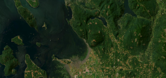
WA 11, Chuckanut Drive, twists along the wooded cliffs above Samish Bay between Bellingham and the Skagit flats, the water glinting through the trees below. Slow and scenic; mind the narrow blind bends, the cyclists, and rockfall after rain.
Scenery
CoastForest
Best seasons
SpringSummerAutumn
In these collections
In these guides
Where it runs11.3 mi · point to point
BellinghamStart · Washington
EdisonEnd · Washington
Navigate to the start: Apple Maps · Google Maps
Character
Corners34bends
Tightness5of 10
Max gradient6%≈ 1-in-17
Hairpins1tight bends
Descent190 mtotal descent
Summit76.9 mhighest point of the line · 252 ft
Corners
busiest around mile 7Elevation
under 4%4–8%over 8%1.5 – 76.9 mPoints of interest2 stops
- Chuckanut Drive Heritage MarkerViewpoint5.1 mi in
- Samish OverlookViewpoint7.4 mi in
Hazards
- Narrow blind bends
- Cyclists on the carriageway
- Rockfall after rain
Sources
“Hugging the cliffs over Chuckanut and Samish Bay, this drive is sometimes referred to as Washington's Big Sur.”
Verified route: mapped from real road geometry and fact-checked by a human editor. How roads get checked
Driving the Chuckanut Drive: quick answers
How long does it take to drive the Chuckanut Drive?
Chuckanut Drive runs 11.3 miles (18 km) and takes about 23 min to drive without stops.
How difficult is the Chuckanut Drive to drive?
We rate it moderate: 34 corners including 1 hairpins, a maximum gradient of 6%, and a tightness of 5 out of 10.
When is the best time to drive the Chuckanut Drive?
Spring and Summer and Autumn are best.
Nearby roads
The closest great drives to Chuckanut Drive.
Chuckanut Drive
DirectionsGet the app