Grisons · Switzerland
Flüela Pass
28Davos to Susch
A bare, beautiful pass between Davos and the Engadin.
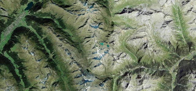
The Flüela Pass at 2,383 m links Davos and Susch in the Lower Engadin, a high, treeless crossing past two small lakes beneath the Flüela Schwarzhorn. Wide, fast and scenic; carry warm clothes, watch for snow late into spring, and mind the cyclists on the long climbs.
Scenery
MountainLakes
Best seasons
SummerAutumn
In these collections
In these Grand Tours
In these guides
Where it runs15.9 mi · point to point
DavosStart · Grisons
SuschEnd · Grisons
Navigate to the start: Apple Maps · Google Maps
Character
Corners38bends
Tightness6of 10
Max gradient9%≈ 1-in-11
Hairpins13tight bends
Climb833 mtotal ascent
Summit2,386.1 mhighest point of the line · 7,828 ft
Corners
busiest around mile 14Elevation
under 4%4–8%over 8%1,430.9 – 2,386.1 mFrom the road
Points of interest3 stops
- FlüelapassViewpoint8.1 mi in
- Fresken in der Kirche St. TheodulLandmarkat the start
- SchwarzchopfViewpoint8.7 mi in
Hazards
- Late-spring snow at the top
- Cyclists on the climbs
- Cold, exposed summit
Sources
“When you reach the peak of this magnificent drive, you can stop off at a parking bay and enjoy the stunning visuals of Lake Davorsee and its surrounding area.”
Verified route: mapped from real road geometry and fact-checked by a human editor. How roads get checked
Driving the Flüela Pass: quick answers
How long does it take to drive the Flüela Pass?
Flüela Pass runs 15.9 miles (26 km) and takes about 33 min to drive without stops.
How difficult is the Flüela Pass to drive?
We rate it demanding: 38 corners including 13 hairpins, a maximum gradient of 9%, and a tightness of 6 out of 10.
When is the best time to drive the Flüela Pass?
Summer and Autumn are best.
Nearby roads
The closest great drives to Flüela Pass.
Flüela Pass
DirectionsGet the app