New South Wales · Australia
Grand Pacific Drive
Stanwell Park to Clifton
Cliff-edge coastal road crossing the Sea Cliff Bridge.
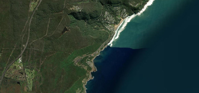
The Lawrence Hargrave Drive section descends Bald Hill and threads the northern Illawarra villages from Stanwell Park to Coalcliff and Clifton. Its centrepiece is the 455 m Sea Cliff Bridge, which carries the road out over the Tasman Sea where the cliffs once dropped rockfalls onto the old alignment. Mind the steep escarpment descent, pedestrians on the bridge, and heavy weekend traffic.
Scenery
Coast
Best seasons
SpringSummerAutumn
In these collections
Where it runs2.5 mi · point to point
Stanwell ParkStart · New South Wales
CliftonEnd · New South Wales
Navigate to the start: Apple Maps · Google Maps
Character
Corners45bends
Tightness6of 10
Max gradient10%≈ 1-in-10
Descent79 mtotal descent
Summit69 mhighest point of the line · 226 ft
Corners
busiest around mile 2Elevation
under 4%4–8%over 8%0.1 – 69 mFrom the road
Points of interest1 stop
- Sea Cliff BridgeViewpoint2.5 mi in
Hazards
- Steep escarpment descent
- Pedestrians on the bridge
- Heavy weekend traffic
Sources
“Driving across it, with the waves crashing below and the cliffs rising beside you, is an unforgettable moment.”
Verified route: mapped from real road geometry and fact-checked by a human editor. How roads get checked
Driving the Grand Pacific Drive: quick answers
How long does it take to drive the Grand Pacific Drive?
Grand Pacific Drive runs 2.5 miles (4.0 km) and takes about 5 min to drive without stops.
How difficult is the Grand Pacific Drive to drive?
We rate it moderate: 45 corners, a maximum gradient of 10%, and a tightness of 6 out of 10.
When is the best time to drive the Grand Pacific Drive?
Spring and Summer and Autumn are best.
Nearby roads
The closest great drives to Grand Pacific Drive.
Grand Pacific Drive
DirectionsGet the app