Victoria · Australia
Great Alpine Road
B500Bright to Omeo
Australia’s highest year-round sealed road over Mount Hotham.
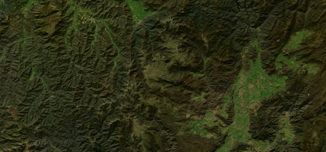
The climb from Bright through Harrietville over Mount Hotham to Omeo is the spine of Victoria’s alpine country, cresting near 1840 m. The fully sealed road winds through snow-gum ridgelines with long sweeping bends and steep grades. Mind winter snow and ice, compulsory chains in the declared season, and fog near the summit.
Where it runs68.1 mi · point to point
BrightStart · Victoria
OmeoEnd · Victoria
Navigate to the start: Apple Maps · Google Maps
Character
Corners220bends
Tightness7of 10
Max gradient12%≈ 1-in-8
Climb2,314 mtotal ascent
Summit1,840.5 mhighest point of the line · 6,038 ft
The highest road in Australia, by our count in the catalogue.
Corners
busiest around mile 20Elevation
under 4%4–8%over 8%309.3 – 1,840.5 mFrom the road
Points of interest3 stops
- Renes LookoutViewpoint29 mi in
- Kosciusko LookoutViewpoint63 mi in
- Pioneer Hill LookoutViewpoint66 mi in
Hazards
- Winter snow and ice
- Compulsory snow chains in season
- Summit fog
Sources
“It's said to be Australia's highest year-round accessible sealed road and one of the most scenic drives in the world.”
Verified route: mapped from real road geometry and fact-checked by a human editor. How roads get checked
Driving the Great Alpine Road: quick answers
How long does it take to drive the Great Alpine Road?
Great Alpine Road runs 68.1 miles (110 km) and takes about 2 h 30 min to drive without stops.
How difficult is the Great Alpine Road to drive?
We rate it demanding: 220 corners, a maximum gradient of 12%, and a tightness of 7 out of 10.
When is the best time to drive the Great Alpine Road?
Summer and Autumn are best.
Nearby roads
The closest great drives to Great Alpine Road.
Great Alpine Road
DirectionsGet the app