New York · United States
Hawk's Nest Highway
NY 97Sparrow Bush to Barryville
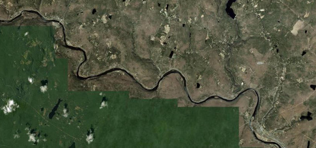
Carved into the cliffs above the Upper Delaware with just a low stone parapet at the edge, the stretch you will recognise from car commercials.
NY 97 along the Upper Delaware curls through the Hawk’s Nest, a tight, low-walled run carved into the cliffs high above the river, a famous stretch long used as a backdrop for car commercials. Mind the low stone parapet, the oncoming traffic on the bends, and motorbikes at weekends.
Scenery
ValleyForest
Best seasons
SpringSummerAutumn
In these collections
Where it runs15.7 mi · point to point
Sparrow BushStart · New York
BarryvilleEnd · New York
Navigate to the start: Apple Maps · Google Maps
Character
Corners26bends
Tightness6of 10
Max gradient5%≈ 1-in-20
Climb289 mtotal ascent
Summit231.9 mhighest point of the line · 761 ft
Corners
busiest around mile 12Elevation
under 4%4–8%over 8%149.8 – 231.9 mFrom the road
Points of interest1 stop
- Lifting Rocks OverlookViewpoint1.3 mi in
Hazards
- Low parapet over a cliff drop
- Oncoming traffic on tight bends
- Weekend motorbike traffic
Sources
“It's a short, rolling breathtaking drive but with many twists and stunning views, especially in summer and autumn.”
Verified route: mapped from real road geometry and fact-checked by a human editor. How roads get checked
Driving the Hawk's Nest Highway: quick answers
How long does it take to drive the Hawk's Nest Highway?
Hawk’s Nest Highway runs 15.7 miles (25 km) and takes about 33 min to drive without stops.
How difficult is the Hawk's Nest Highway to drive?
We rate it moderate: 26 corners, a maximum gradient of 5%, and a tightness of 6 out of 10.
When is the best time to drive the Hawk's Nest Highway?
Spring and Summer and Autumn are best.
Nearby roads
The closest great drives to Hawk's Nest Highway.
Hawk's Nest Highway
DirectionsGet the app