Lombardy · Italy
Passo dello Spluga
SS36Campodolcino to Rheinwald
A vertiginous old trading pass of stacked stone hairpins.
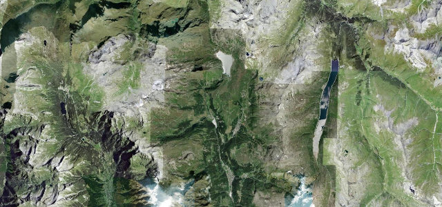
The SS36 over the Splügen Pass at 2,115 m links Italy and Switzerland by way of a tight, narrow stack of stone-walled hairpins between Campodolcino and Pianazzo. Spectacular and demanding, barely two cars wide in places; mind the gradient, the drop, and snow that lingers late.
Where it runs10.9 mi · point to point
CampodolcinoStart · Lombardy
RheinwaldEnd · Lombardy
Navigate to the start: Apple Maps · Google Maps
Character
Corners48bends
Tightness9of 10
Max gradient12%≈ 1-in-8
Hairpins24tight bends
Climb1,062 mtotal ascent
Summit2,117.1 mhighest point of the line · 6,946 ft
Corners
busiest around mile 2Elevation
under 4%4–8%over 8%1,086.8 – 2,117.1 mFrom the road
Points of interest3 stops
- Acque RosseViewpoint4.3 mi in
- Passo dello SplugaViewpoint11 mi in
- Monumento ai Caduti di PianazzoLandmark2.9 mi in
Hazards
- Very narrow stone hairpins
- Big unguarded drops
- Late-lying snow
- Steep gradients
Sources
“This is a stunning road that twists and turns ever upwards but also has several long straights and sweeping curves.”
Verified route: mapped from real road geometry and fact-checked by a human editor. How roads get checked
Driving the Passo dello Spluga: quick answers
How long does it take to drive the Passo dello Spluga?
Passo dello Spluga runs 10.9 miles (18 km) and takes about 27 min to drive without stops.
How difficult is the Passo dello Spluga to drive?
We rate it expert: 48 corners including 24 hairpins, a maximum gradient of 12%, and a tightness of 9 out of 10.
When is the best time to drive the Passo dello Spluga?
Summer and Autumn are best.
Nearby roads
The closest great drives to Passo dello Spluga.
Passo dello Spluga
DirectionsGet the app