Bavaria · Germany
Rossfeld Panoramastraße
Berchtesgaden to Eck
Germany’s highest panoramic ring road near Berchtesgaden.
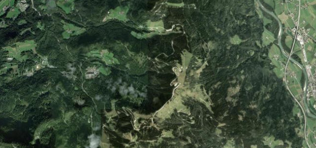
This tolled ring road climbs above 1,500 metres at the eastern end of the Deutsche Alpenstraße near Berchtesgaden, with broad sweeping bends and views toward the Austrian Alps. It was built between 1937 and 1940 and runs roughly 15 kilometres as a loop. Mind the toll booths, frequent cyclists and weekend tourist traffic.
Scenery
MountainValleyForest
Best seasons
SpringSummerAutumn
In these collections
Where it runs8.8 mi · point to point
BerchtesgadenStart · Bavaria
EckEnd · Bavaria
Navigate to the start: Apple Maps · Google Maps
Character
Corners30bends
Tightness5of 10
Max gradient13%≈ 1-in-8
Hairpins3tight bends
Climb681 mtotal ascent
Summit1,545.3 mhighest point of the line · 5,070 ft
The highest road in Germany, by our count in the catalogue.
Corners
busiest around mile 5Elevation
under 4%4–8%over 8%928.8 – 1,545.3 mFrom the road
Points of interest3 stops
- RoßfeldViewpoint3.9 mi in
- GeißstallhöheViewpoint0.7 mi in
- KarkopfViewpoint2.4 mi in
Hazards
- Toll payable at both booths
- Cyclists on the climb
- Busy on summer weekends
Sources
“The drive is very scenic, offering stunning views in every possible direction”
Verified route: mapped from real road geometry and fact-checked by a human editor. How roads get checked
Driving the Rossfeld Panoramastraße: quick answers
How long does it take to drive the Rossfeld Panoramastraße?
Rossfeld Panoramastraße runs 8.8 miles (14.2 km) and takes about 17 min to drive without stops.
How difficult is the Rossfeld Panoramastraße to drive?
We rate it moderate: 30 corners including 3 hairpins, a maximum gradient of 13%, and a tightness of 5 out of 10.
When is the best time to drive the Rossfeld Panoramastraße?
Spring and Summer and Autumn are best.
Is there a toll on the Rossfeld Panoramastraße?
Toll payable at both booths.
Nearby roads
The closest great drives to Rossfeld Panoramastraße.
Rossfeld Panoramastraße
DirectionsGet the app