Quebec · Canada
Route du Fleuve
Route 362Baie-Saint-Paul to La Malbaie
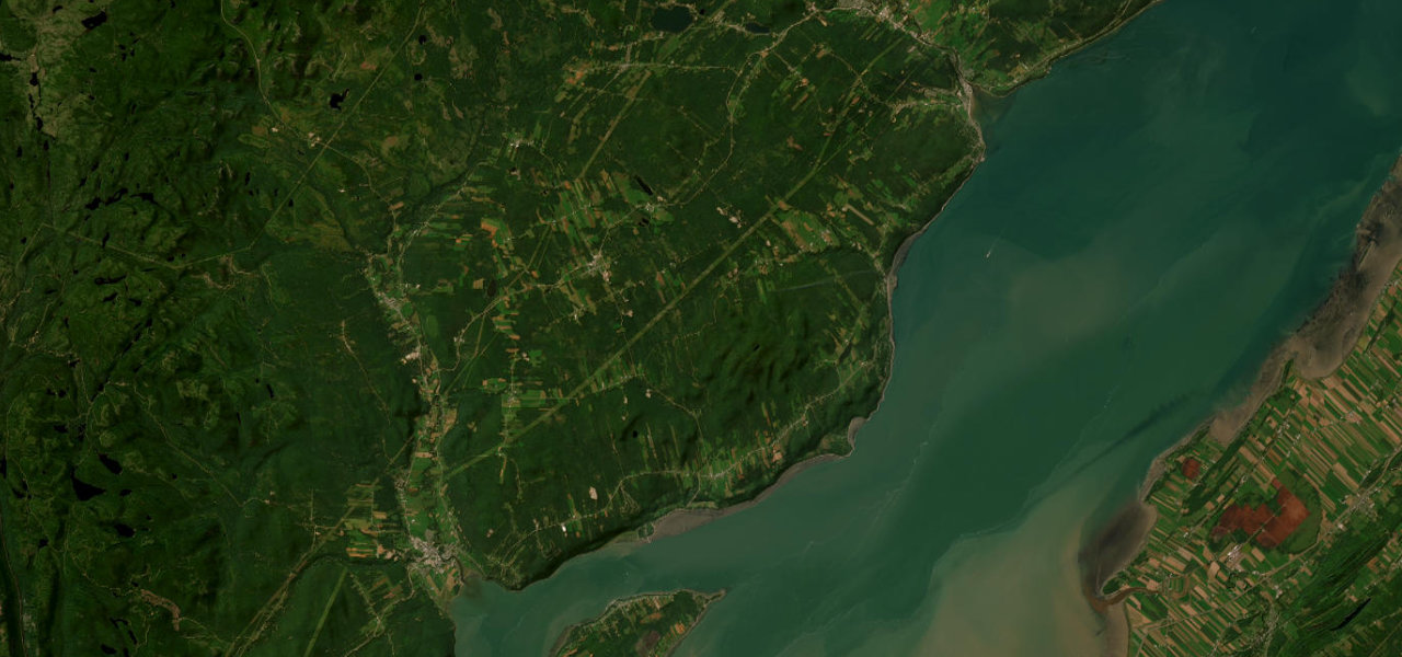
The Route du Fleuve leaves Baie-Saint-Paul and rolls over hills above the St Lawrence through Les Éboulements and Saint-Irénée to La Malbaie, a scenic alternative to the direct Route 138 that is about 48 km long.
Route 362 begins at Route 138 on the west side of Baie-Saint-Paul and runs through the town, which Wikivoyage calls a city of the arts, past the contemporary art museum. It then climbs out of town past the Belvédère de la Vigie and follows the bluffs above the St Lawrence, going up and down some serious hills next to the river. Around Les Éboulements, about 19 km in, the road runs between roughly 270 and 320 m above sea level, and the village is reputed to sit at the centre of a meteorite impact crater 54 km across. East of the village the road drops to Saint-Irénée, with its beach, the Capelans jetty and the Jean-Noël falls tumbling down the moraine. The last stretch passes the Charlevoix astroblème observatory and the Musée de Charlevoix before it ends at Route 138 in La Malbaie.
Scenery
Best seasons
In these collections
Route du Fleuve on the map29.8 mi · point to point
Navigate to the start: Apple Maps · Google Maps
Character
Corners
busiest around mile 21Elevation
under 4%4 to 8%over 8%4 to 383 mPoints of interest6 stops
- Belvédère de la VigieRoadside lookout on the climb east of Baie-Saint-Paul.2.4 mi in
- Baie-Saint-Paul contemporary art museumContemporary art museum in the centre of Baie-Saint-Paul, a town known for its artists.0.8 mi in
- Belvédère des ÉboulementsLookout above the St Lawrence at Les Éboulements, where the road is 270 to 320 m above sea level.11 mi in
- Café SolCooperative café in the village of Les Éboulements.12 mi in
- Belvédère de la chute Jean-NoëlLookout over the Jean-Noël falls, which drop down the moraine at Saint-Irénée.21 mi in
- Observatoire de l’AstroblèmeAstronomical observatory and astroblème centre on the La Malbaie side of the drive.26 mi in
Hazards
- Serious hills and bends beside the river
- Paving works listed for the Route du Fleuve at Baie-Saint-Paul and Les Éboulements in 2024 to 2026
- Short unplanned closures, such as the Saint-Irénée section shut by a manure spill on 16 September 2026
See the typical season and live conditions for the high passes ›
Sources
“The presence of the river and the mountains offer impressive views thanks to the altitude of the road, especially in the Les Éboulements sector. This exhilarating panoramic circuit is one of the most picturesque in Quebec.”
“Explore the St. Lawrence Route in Charlevoix, a panoramic Quebec scenic drive along the St. Lawrence River between Baie-Saint-Paul, Les Éboulements and La Malbaie.”
“Route 362 is a scenic 50 km two-lane highway which follows the Saint Lawrence River in the Charlevoix region in Quebec, Canada.”
Route traced from OpenStreetMap, with its stats measured from that line. How the roads are mapped
Driving the Route du Fleuve: quick answers
How long does it take to drive the Route du Fleuve?
How difficult is the Route du Fleuve to drive?
When is the best time to drive the Route du Fleuve?
Nearby roads
The closest great drives to Route du Fleuve.