Balearic Islands · Spain
Sa Calobra
Ma-2141Coll dels Reis to Sa Calobra
Mallorca’s coiled serpent, a road that ties itself in a knot.
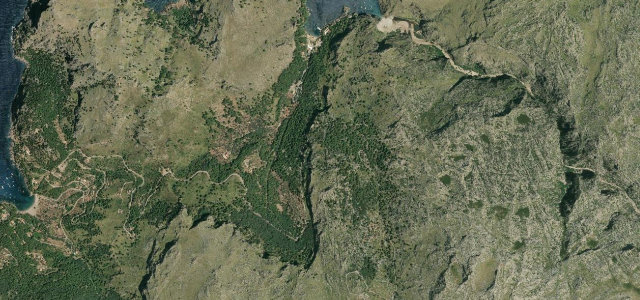
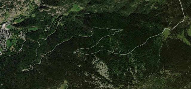
The Ma-2141 drops from the Coll dels Reis to the cove of Sa Calobra in a dizzying series of switchbacks, famously curling under itself in a full 270-degree 'tie knot'. Carved into the Tramuntana mountains above the sea, it is short, spectacular and very popular, go early to have the curves to yourself.
A road tied in a literal knot, the Nus de sa Corbata. A small Mallorcan masterpiece of engineering.
Why we picked it
Scenery
MountainCoast
Best seasons
SpringSummerAutumn
In these collections
Where it runs2.7 mi · point to point
Coll dels ReisStart · Balearic Islands
Sa CalobraEnd · Balearic Islands
Navigate to the start: Apple Maps · Google Maps
Character
Corners26bends
Tightness9of 10
Max gradient11%≈ 1-in-9
Hairpins1tight bends
Descent307 mtotal descent
Summit315.1 mhighest point of the line · 1,034 ft
Corners
busiest around mile 1Elevation
under 4%4–8%over 8%34.5 – 315.1 mFrom the road
Points of interest3 stops
- sa BretxaViewpoint1.0 mi in
- pas d’en MaiolViewpoint2.7 mi in
- Salt de s’AigoLandmark1.5 mi in
Hazards
- Extremely tight switchbacks
- Tour buses on blind bends
- Cyclists in numbers
Sources
“among one of the finest piece of road you could possibly find on the planet”
Verified route: mapped from real road geometry and fact-checked by a human editor. How roads get checked
Driving the Sa Calobra: quick answers
How long does it take to drive the Sa Calobra?
Sa Calobra runs 2.7 miles (4.3 km) and takes about 7 min to drive without stops.
How difficult is the Sa Calobra to drive?
We rate it expert: 26 corners including 1 hairpins, a maximum gradient of 11%, and a tightness of 9 out of 10.
When is the best time to drive the Sa Calobra?
Spring and Summer and Autumn are best.
Nearby roads
The closest great drives to Sa Calobra.
Sa Calobra
DirectionsGet the app