Idaho · United States
Sawtooth Scenic Byway
75Stanley to Ketchum
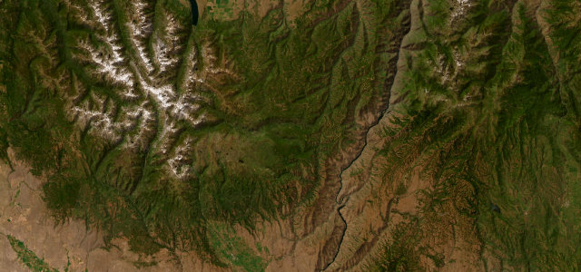
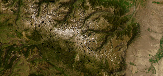
Idaho State Highway 75 over 8701 ft Galena Summit, with the jagged Sawtooth peaks filling the valley below.
State Highway 75 carries the Sawtooth Scenic Byway between the resort town of Ketchum and Stanley, climbing over Galena Summit at 8701 ft, said to be the highest highway summit in the region. The drop from the summit into the Sawtooth Valley reveals one of the most striking ranges in the United States, with more than fifty peaks over 10,000 ft rising to the west and the headwaters of the Salmon River threading the meadows below. It runs through the Sawtooth National Recreation Area, with alpine lakes, river access and abundant wildlife along the way. Mind the up-to-six-percent grades and switchbacks on Galena, winter snow and ice at altitude, and wildlife on the road at dawn and dusk.
Where it runs61.2 mi · point to point
Navigate to the start: Apple Maps · Google Maps
Character
Corners
busiest around mile 32Elevation
under 4%4–8%over 8%1,780.1 – 2,657.1 mFrom the road
Points of interest3 stops
- Galena SummitViewpoint32 mi in
- Bethine & Frank Church OverlookViewpoint31 mi in
- Phantom HillViewpoint49 mi in
Hazards
- Snow and ice at altitude
- Switchbacks on Galena Summit
- Wildlife on the road at dawn and dusk
Sources
“The view as you drop from Galena Summit into the Sawtooth Valley is one that you won't soon forget.”
Verified route: mapped from real road geometry and fact-checked by a human editor. How roads get checked
Driving the Sawtooth Scenic Byway: quick answers
How long does it take to drive the Sawtooth Scenic Byway?
How difficult is the Sawtooth Scenic Byway to drive?
When is the best time to drive the Sawtooth Scenic Byway?
Nearby roads
The closest great drives to Sawtooth Scenic Byway.