Hokkaido · Japan
Shiretoko Pass (Route 334)
334Utoro, Shari to Rausu
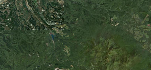
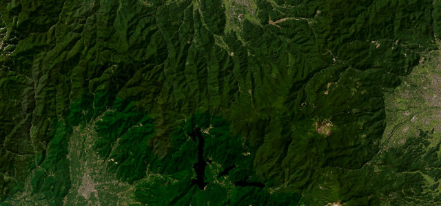
From the 738 m pass the cone of Mount Rausu rises dead ahead, primeval oak and fir falling away toward the Nemuro Strait and, on a clear day, Kunashiri Island. Deep snow walls the road shut through winter and spring, and brown bears turn up on the verges once it opens.
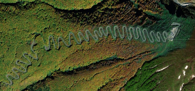
The Shiretoko Crossing Road carries National Route 334 over Shiretoko Pass at 738 metres, linking Utoro on the Sea of Okhotsk side with the fishing town of Rausu on the Nemuro Strait, through the heart of the UNESCO-listed Shiretoko peninsula. From the pass the cone of Mount Rausu rises directly ahead and a sea of primeval oak and fir forest falls away below; on clear days the strait and Kunashiri Island are visible. The road climbs and descends in long, mostly open mountain curves through wild country with no settlements between the two towns. It is the only national highway in Hokkaido with a seasonal closure and one of the shortest-open roads in Japan, walled by deep snow in winter and spring. Mind the long winter and early-spring closure, sudden sea fog and brown-bear sightings near the verges, and the exposed, weather-prone summit.
Where it runs19.6 mi · point to point
Navigate to the start: Apple Maps · Google Maps
Character
Corners
busiest around mile 15Elevation
under 4%4–8%over 8%4.9 – 751.4 mPoints of interest3 stops
- Shiretoko PassViewpoint9.5 mi in
- Kumagoe FallLandmark17 mi in
- Furepe waterfall lookout pointViewpoint2.5 mi in
Hazards
- Long winter and early-spring closure
- Sea fog and roadside brown bears
- Exposed weather-prone summit
Is Shiretoko Pass (Route 334) open? Typical season and live summit weather ›
Sources
“the majestic peak of Mt. Rausu towers with imposing dignity, while a vast sea of deep green forest stretches endlessly below”
Verified route: mapped from real road geometry and fact-checked by a human editor. How roads get checked
Driving the Shiretoko Pass (Route 334): quick answers
How long does it take to drive the Shiretoko Pass (Route 334)?
How difficult is the Shiretoko Pass (Route 334) to drive?
When is the best time to drive the Shiretoko Pass (Route 334)?
Nearby roads
The closest great drives to Shiretoko Pass (Route 334).