Colorado · United States
Slumgullion Pass
CO 149Lake City to Creede
Steep San Juan climb on the Silver Thread Byway.
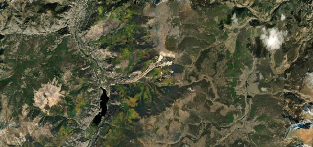
CO 149, the Silver Thread Byway, climbs from Lake City over Slumgullion Pass at 11,530 feet to Spring Creek Pass. The north side is one of the steepest continuously paved grades in Colorado at nearly ten percent, with tight turns through San Juan forest and meadows. Mind the high altitude, sharp grades, and winter storms.
Scenery
MountainForestValley
Best seasons
SummerAutumn
In these collections
In these guides
Where it runs15.4 mi · point to point
Lake CityStart · Colorado
CreedeEnd · Colorado
Navigate to the start: Apple Maps · Google Maps
Character
Corners30bends
Tightness6of 10
Max gradient10%≈ 1-in-10
Climb906 mtotal ascent
Summit3,522.1 mhighest point of the line · 11,555 ft
Higher than 9 in 10 roads in the catalogue.
Corners
busiest around mile 9Elevation
under 4%4–8%over 8%2,640.4 – 3,522.1 mPoints of interest3 stops
- Windy Point Observation SiteViewpoint8.3 mi in
- Slumgullion PassViewpoint9.7 mi in
- Alferd Packer MemorialLandmark2.9 mi in
Hazards
- High altitude over 11,000 feet
- Steep sustained grades
- Winter snow and ice
Sources
“Windy Point Overlook, approximately 2 miles west of the pass, offers stunning views of numerous peaks exceeding 13,000 feet.”
Verified route: mapped from real road geometry and fact-checked by a human editor. How roads get checked
Driving the Slumgullion Pass: quick answers
How long does it take to drive the Slumgullion Pass?
Slumgullion Pass runs 15.4 miles (25 km) and takes about 32 min to drive without stops.
How difficult is the Slumgullion Pass to drive?
We rate it moderate: 30 corners, a maximum gradient of 10%, and a tightness of 6 out of 10.
When is the best time to drive the Slumgullion Pass?
Summer and Autumn are best.
Nearby roads
The closest great drives to Slumgullion Pass.
Slumgullion Pass
DirectionsGet the app