Colorado · United States
Mount Blue Sky Road
CO 5Echo Lake to Mount Blue Sky
The highest paved road in North America, climbing past 14,000 ft.
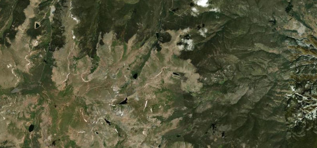
CO 5 climbs from Echo Lake toward the summit of Mount Blue Sky (formerly Mount Evans), winding above the treeline past alpine lakes and mountain goats to the highest paved road in North America near 14,000 ft. Open only in summer; mind the severe altitude, the sheer unguarded edges, and the rapid weather changes.
Where it runs14.0 mi · point to point
Echo LakeStart · Colorado
Mount Blue SkyEnd · Colorado
Navigate to the start: Apple Maps · Google Maps
Character
Corners38bends
Tightness7of 10
Max gradient9%≈ 1-in-11
Hairpins11tight bends
Climb1,074 mtotal ascent
Summit4,310.8 mhighest point of the line · 14,143 ft
Higher than 9 in 10 roads · the highest road in the United States, by our count in the catalogue.
Corners
busiest around mile 13Elevation
under 4%4–8%over 8%3,267.3 – 4,310.8 mPoints of interest3 stops
- Mount Blue Sky SummitLandmark14 mi in
- Goliath PeakViewpoint3.7 mi in
- Mount WarrenViewpoint8.2 mi in
Hazards
- Extreme altitude
- Sheer unguarded drops
- Lightning and sudden storms
Sources
“The road has many switchbacks on the mountain and terrifying drop-offs without guardrails.”
Verified route: mapped from real road geometry and fact-checked by a human editor. How roads get checked
Driving the Mount Blue Sky Road: quick answers
How long does it take to drive the Mount Blue Sky Road?
Mount Blue Sky Road runs 14.0 miles (23 km) and takes about 31 min to drive without stops.
How difficult is the Mount Blue Sky Road to drive?
We rate it demanding: 38 corners including 11 hairpins, a maximum gradient of 9%, and a tightness of 7 out of 10.
When is the best time to drive the Mount Blue Sky Road?
Summer is best.
Nearby roads
The closest great drives to Mount Blue Sky Road.
Mount Blue Sky Road
DirectionsGet the app