Lombardy · Italy
Strada Regina (Lake Como)
SS340Cernobbio to Menaggio
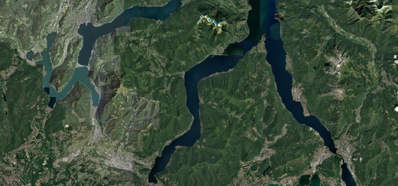
The SS340 follows the line of the old Via Regina up the west shore of Lake Como, from Cernobbio past Argegno, Isola Comacina and the villas of Tremezzina to Menaggio, slow through narrow villages but rarely steep.
From the junction at Cernobbio the SS340 passes the town in a tunnel of about 2.4 km, then follows a late 1960s variant cut along the hillside above Moltrasio to Torriggia in Laglio, with few junctions and limits of 50 to 70 km/h. Beyond Laglio it bypasses Brienno in a second tunnel and reaches Argegno, where the Val d’Intelvi road leaves for Porlezza. The stretch on to Colonno is protected by rockfall barriers, and from Colonno through Sala Comacina, opposite Isola Comacina, and the villages of Tremezzina to Griante the road squeezes through every village, with traffic lights that let buses and lorries through one direction at a time. A bypass, mostly in tunnel, is being built behind these villages from Colonno to Griante, so expect works near both ends. Past Villa Carlotta at Tremezzo and Cadenabbia the road reaches Menaggio, where the SS340 turns inland for Porlezza and Lake Lugano and the SS340dir carries on up the shore. Speeds are low, with blind corners and local buses that need the whole road, but the curves are gentle and the gradients slight.
Scenery
Best seasons
In these collections
Strada Regina (Lake Como) on the map17.2 mi · point to point
Navigate to the start: Apple Maps · Google Maps
Character
Corners
busiest around mile 9Elevation
under 4%4 to 8%over 8%190 to 305 mPoints of interest5 stops
- Belvedere Giancarlo VenelliNamed viewpoint over the lake at Laglio, about 150 m from the road.4.9 mi in
- ArgegnoLakeside village near the halfway point, where the road up the Val d’Intelvi leaves for Porlezza.9.5 mi in
- Isola ComacinaIsland just offshore from Sala Comacina, reached by boat.13 mi in
- Villa del BalbianelloVilla at the tip of the Dosso di Lavedo headland, with a water taxi stop at Lenno.13 mi in
- Villa CarlottaVilla and museum on the shore at Tremezzo, right beside the road.16 mi in
Hazards
- Narrow pinch points in the villages, with traffic lights for buses and lorries
- Local buses that need the full width on blind corners
- Rockfall between Argegno and Colonno, with short closures to clear the barriers
- Bypass tunnel works near Colonno and Griante
- Summer weekend queues through the lakeside villages
See the typical season and live conditions for the high passes ›
Sources
“The Lake Como coastal road, known as "via Regina", identified as one of the best road for the ultimate summer drive”
“La strada statale 340 Regina è una delle più amate dai motociclisti (ma anche dai ciclisti) del Nord Italia a causa della bellezza del percorso, ricco di curve, e del paesaggio circostante.”
“La SS340 è una strada molto bella da percorrere in moto, affacciata sul lago presenta dolci e continue curve con leggeri saliscendi e offre continui panorami di particolare bellezza.”
Route traced from OpenStreetMap, with its stats measured from that line. How the roads are mapped
Driving the Strada Regina (Lake Como): quick answers
How long does it take to drive the Strada Regina (Lake Como)?
How difficult is the Strada Regina (Lake Como) to drive?
When is the best time to drive the Strada Regina (Lake Como)?
Nearby roads
The closest great drives to Strada Regina (Lake Como).