Tyrol · Austria
Zillertaler Höhenstraße
Kaltenbach/Ried to Hippach
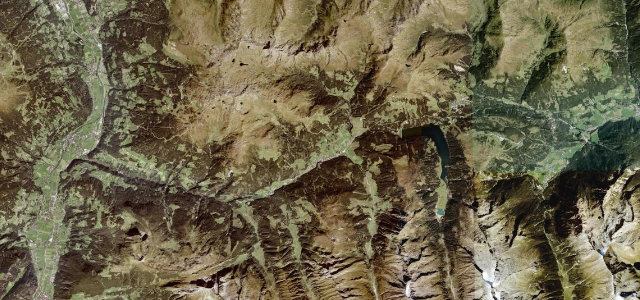
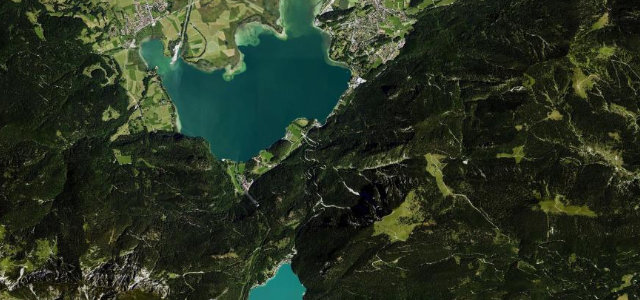
A narrow toll shelf high above the Zillertal, topping out around 2,020 m, built for the grandstand view across to the Tux and Zillertal Alps rather than for pace.
This toll road runs as a panoramic shelf high above the Zillertal, linking pastures and viewpoints along the ridge with grandstand views across the valley to the Tux and Zillertal Alps, topping out around 2020 m. It is a narrow, twisting mountain road built for the views rather than for pace, with several access spurs feeding the ridge run. Surface and width vary and it is popular with motorbikes and cyclists. Mind the narrow single-track stretches, blind crests and the steep unguarded drops on the valley side.
Where it runs12.4 mi · point to point
Navigate to the start: Apple Maps · Google Maps
Character
Corners
busiest around mile 8Elevation
under 4%4–8%over 8%992.2 – 2,033.9 mFrom the road
Points of interest2 stops
- ArbiskopfViewpoint12 mi in
- RauhenkopfViewpoint12 mi in
Hazards
- Narrow single-track stretches
- Blind crests
- Unguarded valley-side drops
Sources
“You can't drive fast since there are many blind corners and narrow parts, but it's a lot of fun to drive and has beautiful views.”
Verified route: mapped from real road geometry and fact-checked by a human editor. How roads get checked
Driving the Zillertaler Höhenstraße: quick answers
How long does it take to drive the Zillertaler Höhenstraße?
How difficult is the Zillertaler Höhenstraße to drive?
When is the best time to drive the Zillertaler Höhenstraße?
Is there a toll on the Zillertaler Höhenstraße?
Nearby roads
The closest great drives to Zillertaler Höhenstraße.