England · United Kingdom
St Ives to St Just
B3306St. Ives to St Just
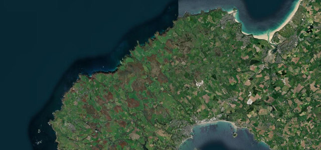
A wild granite-and-Atlantic coast road across the tip of Cornwall.
The B3306 traces the rugged north coast of the Penwith peninsula from St Ives to St Just, between moorland, ancient field walls and the Atlantic. It is narrow and twisting with blind bends and farm traffic; enjoy the drama at a gentle pace.
Out of season, with the weather coming in sideways, this might be our favourite drive in England. We time our visits for the roughest days on purpose.
Why we picked it
Where it runs15.6 mi · point to point
St. IvesStart · England
St JustEnd · England
Navigate to the start: Apple Maps · Google Maps
Character
Corners26bends
Tightness6of 10
Max gradient9%≈ 1-in-11
Climb442 mtotal ascent
Summit187.4 mhighest point of the line · 615 ft
Corners
busiest around mile 4Elevation
under 4%4–8%over 8%16.8 – 187.4 mPoints of interest1 stop
- Plain-an-GwarryLandmark16 mi in
Hazards
- Narrow with blind bends
- Farm traffic and walkers
- Coastal weather
Sources
“Cruising along the road quickly becomes rather unpredictable and you round each bend with an air of anticipation of what lies ahead.”
Verified route: mapped from real road geometry and fact-checked by a human editor. How roads get checked
Driving the St Ives to St Just: quick answers
How long does it take to drive the St Ives to St Just?
St Ives to St Just runs 15.6 miles (25 km) and takes about 33 min to drive without stops.
How difficult is the St Ives to St Just to drive?
We rate it moderate: 26 corners, a maximum gradient of 9%, and a tightness of 6 out of 10.
When is the best time to drive the St Ives to St Just?
Spring and Summer and Autumn are best.
Nearby roads
The closest great drives to St Ives to St Just.
St Ives to St Just
DirectionsGet the app