Fjarðabyggð · Iceland
East Fjords Coast
1Reyðarfjörður to Stöðvarfjörður
Paved Ring Road threading three quiet eastern fjords.
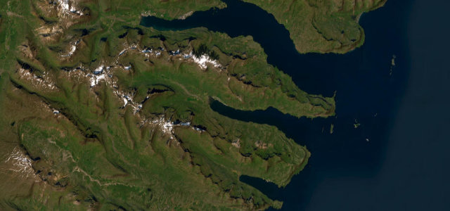
This stretch of Route 1 winds along the East Fjords from Reyðarfjörður through Fáskrúðsfjörður to Stöðvarfjörður, hugging the shoreline below steep basalt mountains and using the 5.9 km Fáskrúðsfjörður tunnel. Route 1 is now fully paved through the region. Mind narrow winding curves, the long Fáskrúðsfjörður tunnel, and reindeer crossing in winter.
Scenery
CoastMountain
Best seasons
SpringSummerAutumn
In these collections
In these Grand Tours
In these guides
Where it runs23.7 mi · point to point
ReyðarfjörðurStart · Fjarðabyggð
StöðvarfjörðurEnd · Fjarðabyggð
Navigate to the start: Apple Maps · Google Maps
Character
Corners150bends
Tightness5of 10
Max gradient8%≈ 1-in-13
Climb700 mapproximate · DEM-limited
Summit165.9 mapproximate · DEM-limited
Corners
busiest around mile 9Elevation
approximateunder 4%4–8%over 8%1 – 165.9 mPoints of interest1 stop
- ReyðarfjörðurViewpoint1.0 mi in
Hazards
- Reindeer on the road
- Winding narrow curves
- Sudden coastal fog
Sources
“The stretch of Route 1 through the Eastfjords is one of Iceland's most scenic drives”
Verified route: mapped from real road geometry and fact-checked by a human editor. How roads get checked
Driving the East Fjords Coast: quick answers
How long does it take to drive the East Fjords Coast?
East Fjords Coast runs 23.7 miles (38 km) and takes about 47 min to drive without stops.
How difficult is the East Fjords Coast to drive?
We rate it moderate: 150 corners, a maximum gradient of 8%, and a tightness of 5 out of 10.
When is the best time to drive the East Fjords Coast?
Spring and Summer and Autumn are best.
Nearby roads
The closest great drives to East Fjords Coast.
East Fjords Coast
DirectionsGet the app