California · United States
Emerald Bay and the West Shore
CA 89South Lake Tahoe to Tahoe City
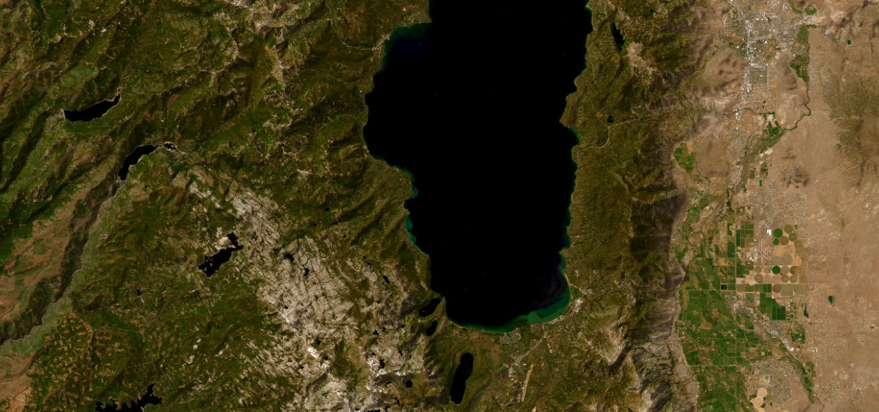
CA 89 leaves the Y in South Lake Tahoe past Camp Richardson, climbs on switchbacks to a ridge high above Emerald Bay, then follows the lake’s west shore through Meeks Bay and Homewood to Tahoe City.
CA 89 splits from US 50 at the Y in South Lake Tahoe and follows Emerald Bay Road north past Camp Richardson. A series of sweeping switchbacks takes it well above the lake, and at the top of the grade it enters Emerald Bay State Park and follows a narrow ridge that barely fits two lanes, with a vista point looking down on the bay and Fannette Island, the only island in Lake Tahoe. The road was first built in 1913 and was among the hardest stretches of highway to build around the lake, with granite blasted away for a surface. Beyond the Eagle Falls and Vikingsholm turnoffs it runs on along the west shore through Meeks Bay, Tahoma and Homewood, crossing into Placer County, and ends at the CA 28 junction in Tahoe City. It is narrow with limited shoulders, so expect cyclists in summer and rockslides after snowmelt or heavy rain.
Scenery
Best seasons
In these collections
Emerald Bay and the West Shore on the map26.7 mi · point to point
Navigate to the start: Apple Maps · Google Maps
Character
Corners
busiest around mile 7Elevation
under 4%4 to 8%over 8%1,900 to 2,084 mPoints of interest5 stops
- Camp Richardson’s Coffee & ConfectioneryCafe at Camp Richardson, on the lakeshore just north of South Lake Tahoe.2.6 mi in
- Inspiration PointVista point on the ridge above Emerald Bay, looking down on Fannette Island, the only island in Lake Tahoe.7.6 mi in
- Eagle Falls TrailheadTurnoff for the Eagle Falls car park and the Eagle Lake trailhead, beside Eagle Creek.8.5 mi in
- Meeks Bay BeachBeach and picnic area at Meeks Bay on the west shore.16 mi in
- Obexer’s General Store & DeliGeneral store and deli at Homewood, on the west shore before Tahoe City.20 mi in
Hazards
- Closes at Emerald Bay after winter storms, and slides take a full day to clear
- Narrow ridge section with big drop-offs and no guardrails near Emerald Bay
- Rockslides after snowmelt or heavy rain, with limited shoulders and summer cyclists
- Limited parking at Emerald Bay in summer, especially from 10am to 4pm
- Roadwork in 2026 with one-way traffic control and delays of up to 20 minutes
See the typical season and live conditions for the high passes ›
Sources
“This is one of the most beautiful views in the Lake Tahoe Basin; enjoy!”
“The road is perched high above two beautiful mountain lakes on the drive.”
“Emerald Bay is an iconic part of Lake Tahoe but at least once every winter, Highway 89 closes, cutting off the scenic drive.”
Route traced from OpenStreetMap, with its stats measured from that line. How the roads are mapped
Driving the Emerald Bay and the West Shore: quick answers
How long does it take to drive the Emerald Bay and the West Shore?
How difficult is the Emerald Bay and the West Shore to drive?
When is the best time to drive the Emerald Bay and the West Shore?
Nearby roads
The closest great drives to Emerald Bay and the West Shore.