Kimberley, Western Australia · Australia
Gibb River Road
Home Valley / Pentecost River to Great Northern Highway junction (near Kununurra)
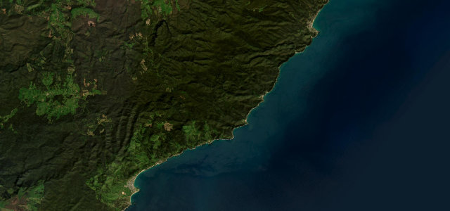
The Kimberley’s legendary outback track, here on its iconic eastern run past the Pentecost River crossing beneath the Cockburn Range.
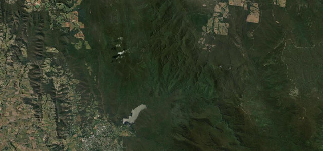
The Gibb River Road is a 660 km mostly-unsealed cattle route across the remote Kimberley between Derby and the Kununurra end, and its most photographed stretch is the eastern run past Home Valley and the Pentecost River crossing, with the red wall of the Cockburn Range looming over the floodplain. This section is corrugated red dirt with a wide, fast tidal river crossing that can hold saltwater crocodiles and rises quickly after rain. It is a true 4WD adventure rather than a sports-car road, rewarded with some of the most spectacular outback scenery in Australia. The road is generally only open and passable in the dry season. Mind the severe corrugations and bulldust, the croc-inhabited Pentecost crossing, and wet-season closures and flooding.
Where it runs40.5 mi · point to point
Navigate to the start: Apple Maps · Google Maps
Character
Corners
busiest around mile 1Elevation
under 4%4–8%over 8%5.4 – 134.7 mFrom the road
Points of interest3 stops
- Pentecost River CrossingLandmark5.5 mi in
- Cockburn Ranges LookoutViewpointat the start
- Home Valley StationFood and drinkat the start
Hazards
- Severe corrugations and bulldust
- Tidal Pentecost crossing with saltwater crocodiles
- Wet-season closures and flooding
See the typical season and live conditions for the high passes ›
Sources
“The road runs through a spectacular landscape of intensely coloured ranges, dramatic gorges and lush rock pools and waterfalls.”
Verified route: mapped from real road geometry and fact-checked by a human editor. How roads get checked
Driving the Gibb River Road: quick answers
How long does it take to drive the Gibb River Road?
How difficult is the Gibb River Road to drive?
When is the best time to drive the Gibb River Road?
Is the Gibb River Road fully paved?
Nearby roads
The closest great drives to Gibb River Road.