Bali · Indonesia
Kintamani Caldera Rim
6Penelokan to Kintamani
Distance3.4 mi5.5 km
Drive time7 minon the road
DifficultyModeratetightness 5 of 10
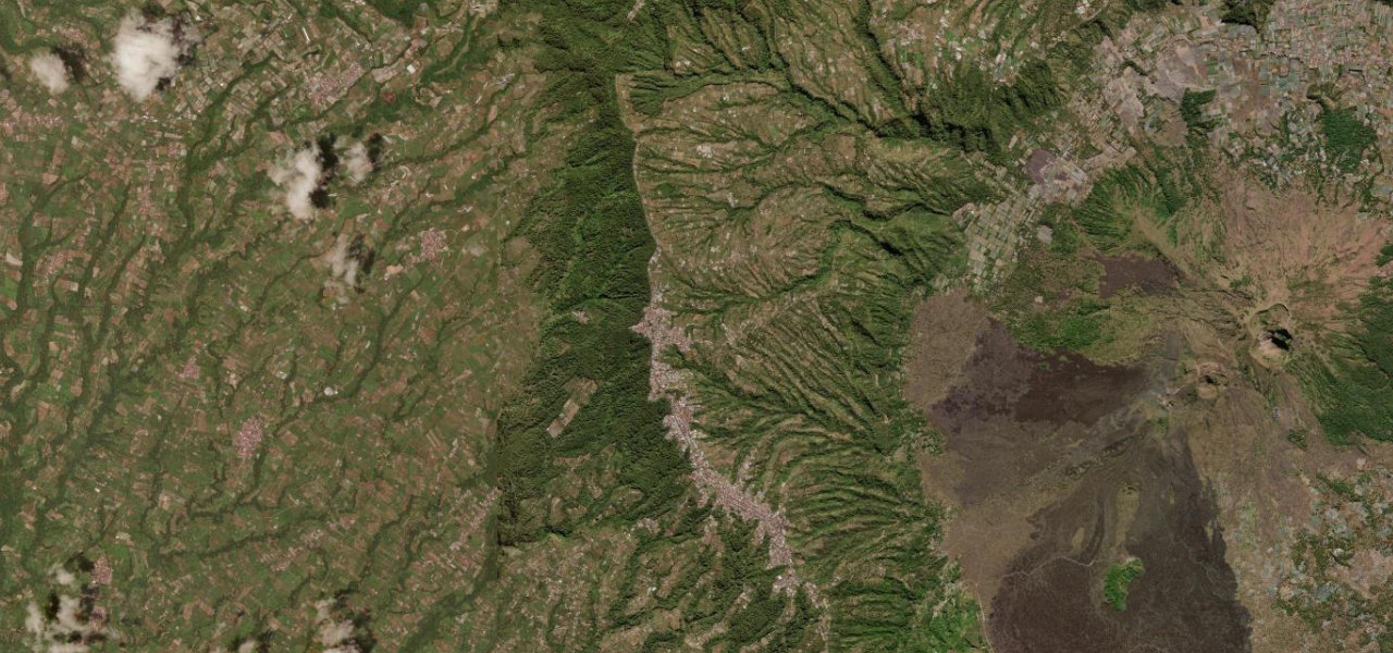
Bali’s most dramatic drive runs the rim of the Mount Batur caldera at ~1,500 m, where a single crest reveals an active volcanic cone, a crater lake and black lava fields in one panorama.
Climbing north from Ubud to Penelokan, the main caldera viewpoint, the rim road continues through Batur village and Kintamani with the volcano brooding across the crater at every turn. It can continue north to Singaraja or loop south via Bedugul for a full scenic circuit.
Scenery
MountainLakesForest
Where it runs
PenelokanStart · Bali
KintamaniEnd · Bali
Navigate to the start: Apple Maps · Google Maps
Character
Corners8bends
Tightness5of 10
Max gradient10%≈ 1-in-10
Climb209 mtotal ascent
Summit1,647 mhighest point of the line · 5,404 ft
Elevation
under 4%4–8%over 8%1,427 – 1,647 mHazards
- morning fog
- steep descents toward the crater lake
- tourist congestion at viewpoints
- narrow sections
Sources: Road geometry © OpenStreetMap contributors
Nearby roads
The closest great drives to Kintamani Caldera Rim.
Kintamani Caldera Rim
Directions