Tyrol · Austria
Hahntennjoch
L246Imst to Hahntennjoch
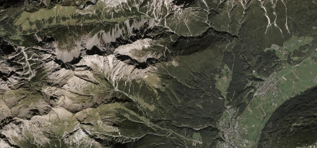
A wild, narrow Tyrolean pass over the Lechtal Alps.
The L246 over the Hahntennjoch at 1,894 m links Imst and the Lechtal, a narrow, dramatic Tyrolean pass through rockfall country and tight switchbacks, beloved of motorcyclists. Demanding and exposed; mind the narrow sections, the loose rock after rain, and the steep, blind bends.
Where it runs8.3 mi · point to point
ImstStart · Tyrol
HahntennjochEnd · Tyrol
Navigate to the start: Apple Maps · Google Maps
Character
Corners36bends
Tightness7of 10
Max gradient11%≈ 1-in-9
Hairpins3tight bends
Climb1,068 mtotal ascent
Summit1,892.4 mhighest point of the line · 6,209 ft
Corners
busiest around mile 7Elevation
under 4%4–8%over 8%824.3 – 1,892.4 mFrom the road
Points of interest3 stops
- HahntennjochViewpoint8.3 mi in
- Burgruine GebratsteinLandmark3.0 mi in
- Hoher ÜbergangViewpoint2.4 mi in
Hazards
- Narrow with oncoming traffic
- Rockfall after rain
- Closed in winter
- Steep blind bends
Is Hahntennjoch open? Typical season and live summit weather ›
Sources
“The road to the summit offers wonderful views along serpentine curves and alpine landscapes.”
Verified route: mapped from real road geometry and fact-checked by a human editor. How roads get checked
Driving the Hahntennjoch: quick answers
How long does it take to drive the Hahntennjoch?
Hahntennjoch runs 8.3 miles (13.4 km) and takes about 18 min to drive without stops.
How difficult is the Hahntennjoch to drive?
We rate it demanding: 36 corners including 3 hairpins, a maximum gradient of 11%, and a tightness of 7 out of 10.
When is the best time to drive the Hahntennjoch?
Summer and Autumn are best. The road closes seasonally over winter; check it has reopened before setting out.
Nearby roads
The closest great drives to Hahntennjoch.
Hahntennjoch
DirectionsGet the app