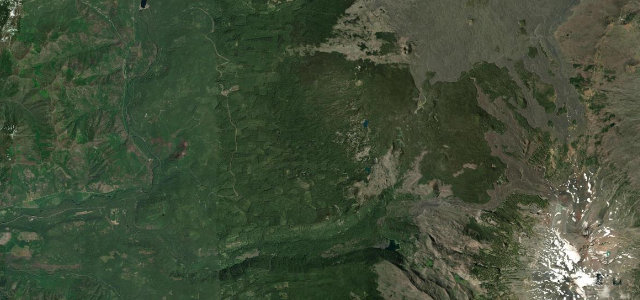
Oregon · United States
McKenzie Pass
OR 242McKenzie Bridge to Sisters
A narrow old highway across a sea of black lava in the Oregon Cascades.
OR 242 over McKenzie Pass winds through old-growth forest to a startling field of black lava at the crest, with the Three Sisters volcanoes rising close beyond. Open only in the warmer months; mind the very narrow, winding sections, the cyclists, and the lack of barriers.
Where it runs21.6 mi · point to point
McKenzie BridgeStart · Oregon
SistersEnd · Oregon
Navigate to the start: Apple Maps · Google Maps
Character
Corners40bends
Tightness6of 10
Max gradient8%≈ 1-in-13
Hairpins5tight bends
Climb1,154 mtotal ascent
Summit1,620.7 mhighest point of the line · 5,317 ft
Corners
busiest around mile 12Elevation
under 4%4–8%over 8%504.9 – 1,620.7 mFrom the road
Points of interest2 stops
- McKenzie PassViewpoint22 mi in
- Upper Proxy FallsLandmark8.9 mi in
Hazards
- Very narrow and winding
- Closed most of the year by snow
- Cyclists on blind bends
Is McKenzie Pass open? Typical season and live summit weather ›
Sources
“From the observatory, you can take in six Cascade peaks on a clear day.”
Verified route: mapped from real road geometry and fact-checked by a human editor. How roads get checked
Driving the McKenzie Pass: quick answers
How long does it take to drive the McKenzie Pass?
McKenzie Pass runs 21.6 miles (35 km) and takes about 45 min to drive without stops.
How difficult is the McKenzie Pass to drive?
We rate it moderate: 40 corners including 5 hairpins, a maximum gradient of 8%, and a tightness of 6 out of 10.
When is the best time to drive the McKenzie Pass?
Summer and Autumn are best. The road closes seasonally over winter; check it has reopened before setting out.
Nearby roads
The closest great drives to McKenzie Pass.
McKenzie Pass
DirectionsGet the app