Florida Keys, Florida · United States
Overseas Highway
US 1Key Largo to Key West
42 bridges and a hundred miles of open water to Key West.
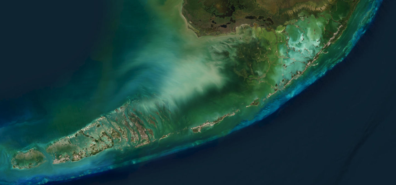
US 1 leaves Key Largo and island-hops a hundred and seven miles to Key West on the roadbed of Flagler’s hurricane-wrecked Overseas Railroad, crossing 42 bridges with the Atlantic on one side and the Gulf of Mexico on the other. The Seven Mile Bridge is the set piece, a low concrete arc over open turquoise water that feels closer to flying than driving, with Bahia Honda’s beaches just beyond. It is one lane each way nearly the whole run, so time it right: peak-season traffic crawls, crosswinds work the long spans, and from June to November this is the Keys' only hurricane evacuation route.
The road that goes to sea. Water on both sides, horizon everywhere, and the Seven Mile Bridge in the middle of it. Nothing else in America drives like it.
Why we picked it
Scenery
Best seasons
In these collections
In these guides
Where it runs107.5 mi · point to point
Navigate to the start: Apple Maps · Google Maps
Character
Elevation
under 4%4–8%over 8%-2 – 12 mThe strip below the profile is corner density: taller, warmer ticks mean tighter bends.
Points of interest3 stops
- Seven Mile BridgeLandmark64 mi in
- Bahia Honda State ParkViewpoint70 mi in
- Mile Marker 0Landmark108 mi in
Hazards
- Peak-season traffic can slow the drive to a crawl
- The Keys' only evacuation route in hurricane season
- Crosswind gusts on the long exposed bridges
- Sudden braking around mile-marker attractions
Verified route: mapped from real road geometry and fact-checked by a human editor. How roads get checked
Driving the Overseas Highway: quick answers
How long does it take to drive the Overseas Highway?
How difficult is the Overseas Highway to drive?
When is the best time to drive the Overseas Highway?
Nearby roads
The closest great drives to Overseas Highway.