Montana · United States
Going-to-the-Sun Road
West Glacier to Saint Mary
A cliff-carved climb over the Continental Divide in Glacier National Park.
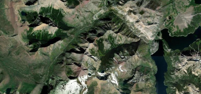
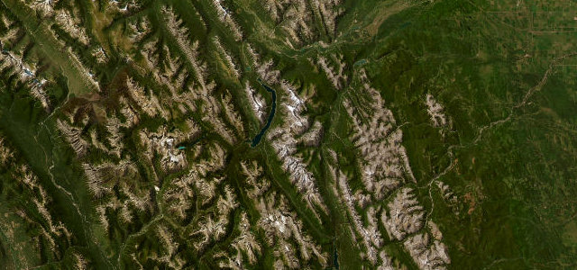
Going-to-the-Sun Road runs about 50 miles clear across Glacier National Park, climbing from the forests of Lake McDonald over Logan Pass, 2,026 m (6,646 ft) on the Continental Divide, and dropping to the shores of St Mary Lake. A 1930s feat of engineering blasted into the cliffs, it is narrow and exposed, past the dripping Weeping Wall and the tight switchback known as The Loop. The alpine section opens only once the snow is cleared (typically late June to mid-October), and vehicles longer than 21 ft or wider than 8 ft are barred from the pass.
America’s most spectacular mountain drive, a ribbon of road pinned to the Divide, with the whole of Glacier falling away beside you.
Why we picked it
Scenery
Best seasons
Featured in
In these collections
In these Grand Tours
In these guides
Where it runs49.9 mi · point to point
Navigate to the start: Apple Maps · Google Maps
Character
Corners
busiest around mile 27Elevation
under 4%4–8%over 8%966.1 – 2,027.4 mFrom the road
Points of interest3 stops
- McDonald Creek OverlookViewpoint14 mi in
- Big BendViewpoint29 mi in
- Golden StaircaseViewpoint43 mi in
Hazards
- Narrow, cliff-edge sections with sheer drops
- Open only in summer, once cleared of snow
- Vehicle size limit over the pass (max 21 ft long / 8 ft wide)
- Sudden alpine weather; ice possible
Is Going-to-the-Sun Road open? Typical season and live summit weather ›
Sources
“the 50-mile Going-to-the-Sun Road offers stunning views of Glacier National Park”
Verified route: mapped from real road geometry and fact-checked by a human editor. How roads get checked
Driving the Going-to-the-Sun Road: quick answers
How long does it take to drive the Going-to-the-Sun Road?
How difficult is the Going-to-the-Sun Road to drive?
When is the best time to drive the Going-to-the-Sun Road?
Nearby roads
The closest great drives to Going-to-the-Sun Road.