Rogaland · Norway
Jæren
Fv44Ogna to Bore
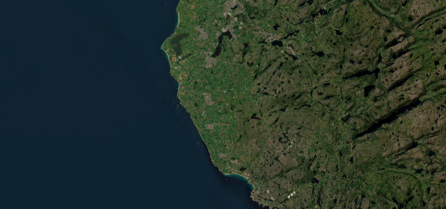
Fv44, the Nordsjøvegen, runs flat along the North Sea from Ogna to Bore, past drystone-walled farmland, the Kvassheim lighthouse and the long sand at Borestranden. When the crosswind gets up, the beach starts arriving on the road.
A National Tourist Route on county road 44, the Nordsjovegen, following the flat North Sea coast of southwestern Norway between Ogna and Bore. The easy open route runs past long sandy beaches such as Borestranden, drystone-walled farmland and the Kvassheim lighthouse. Mind the strong coastal crosswinds, blowing sand and slow farm traffic.
Scenery
Best seasons
In these collections
In these guides
Where it runs24.4 mi · point to point
Navigate to the start: Apple Maps · Google Maps
Character
Corners
busiest around mile 19Elevation
under 4%4–8%over 8%2 – 77.7 mFrom the road
Points of interest3 stops
- KleppevardenViewpoint22 mi in
- BondenLandmark19 mi in
- KrosshaugLandmark20 mi in
Hazards
- Strong coastal crosswinds
- Blowing sand
- Slow agricultural traffic
Sources
“With miles of sandy beaches and sand dunes, only broken by boulders and salmon rivers, it offers stunning views of open skies, wide horizons, and endless ocean.”
Verified route: mapped from real road geometry and fact-checked by a human editor. How roads get checked
Driving the Jæren: quick answers
How long does it take to drive the Jæren?
How difficult is the Jæren to drive?
When is the best time to drive the Jæren?
Nearby roads
The closest great drives to Jæren.