Rogaland · Norway
Lysevegen
Fv500Lysebotn to Øygardstøl
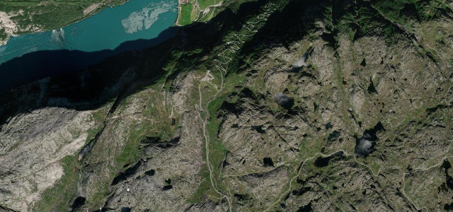
A wall of hairpins climbing from the head of the Lysefjord.
The Lysevegen climbs out of Lysebotn at the head of the Lysefjord on a staircase of tight hairpins, including a spiral tunnel inside the mountain, to the high moorland above. Mind the very tight hairpins, the single-lane sections, and the gated tunnel.
Hairpins stack down the rock face to the fjord floor, tightening the whole way, then a spiralling tunnel finishes it off. Pure drama over dark water.
Why we picked it
Scenery
MountainValley
Best seasons
SpringSummerAutumn
In these collections
In these guides
Where it runs2.8 mi · point to point
LysebotnStart · Rogaland
ØygardstølEnd · Rogaland
Navigate to the start: Apple Maps · Google Maps
Character
Corners30bends
Tightness8of 10
Max gradient10%≈ 1-in-10
Hairpins11tight bends
Climb440 mtotal ascent
Summit787 mhighest point of the line · 2,582 ft
Corners
busiest around mile 1Elevation
under 4%4–8%over 8%347.1 – 787 mPoints of interest1 stop
- Øygardstøl (Eagle’s Nest viewpoint)Viewpoint1.4 mi in
Hazards
- Very tight hairpins
- Single-lane spiral tunnel
- Closed in winter
Sources
“a very popular tourist road in the high mountains of Rogaland”
Verified route: mapped from real road geometry and fact-checked by a human editor. How roads get checked
Driving the Lysevegen: quick answers
How long does it take to drive the Lysevegen?
Lysevegen runs 2.8 miles (4.5 km) and takes about 7 min to drive without stops.
How difficult is the Lysevegen to drive?
We rate it demanding: 30 corners including 11 hairpins, a maximum gradient of 10%, and a tightness of 8 out of 10.
When is the best time to drive the Lysevegen?
Spring and Summer and Autumn are best. The road closes seasonally over winter; check it has reopened before setting out.
Nearby roads
The closest great drives to Lysevegen.
Lysevegen
DirectionsGet the app